Stefano Costa

There's more than potsherds out here

Faccio l’archeologo e vivo a Genova

Categoria: GIS

  • Two new releases for Total Open Station

    A few weeks ago the Total Open Station repository saw a burst of activity, when one blocking issue was finally solved, and that allowed me and the other contributors to release in a short cycle the long awaited 0.6 version, followed by the 0.7 version.

    Version 0.6 is almost entirely the work of psolyca, who added full support for LandXML as both input and output format. The subset of LandXML that is supported is specifically targeted to survey data and we are looking forward to seeing reports from users in the field. There are many applications that are compatible with LandXML. During the 0.6 release cycle, the project adopted a code of conduct, the creation of a Windows portable app (click-and-run, even from a USB stick) was automated, as the continuous testing of the code.

    Version 0.7 is a much simpler story. We switched to the new standard pyproject.toml configuration file for the project metadata, ensuring a cleaner development environment, and we added a variant of the existing CSV output format that is compatible with the LandSurveyCodesImport plugin for QGIS.

    Speaking of QGIS, our contributor Enzo Cocca has created a beautiful plugin for using Total Open Station inside QGIS, with a dedicated interface for the same underlying functionality. For our next release, we have planned to bring some changes and new features that were added in the plugin repository, and align the version that is used (currently 0.5.3).

    The homepage of the project is always at https://tops.iosa.it/ with links to the documentation and downloads. We will be happy to hear your reports and accept your contributions to the development of the software.
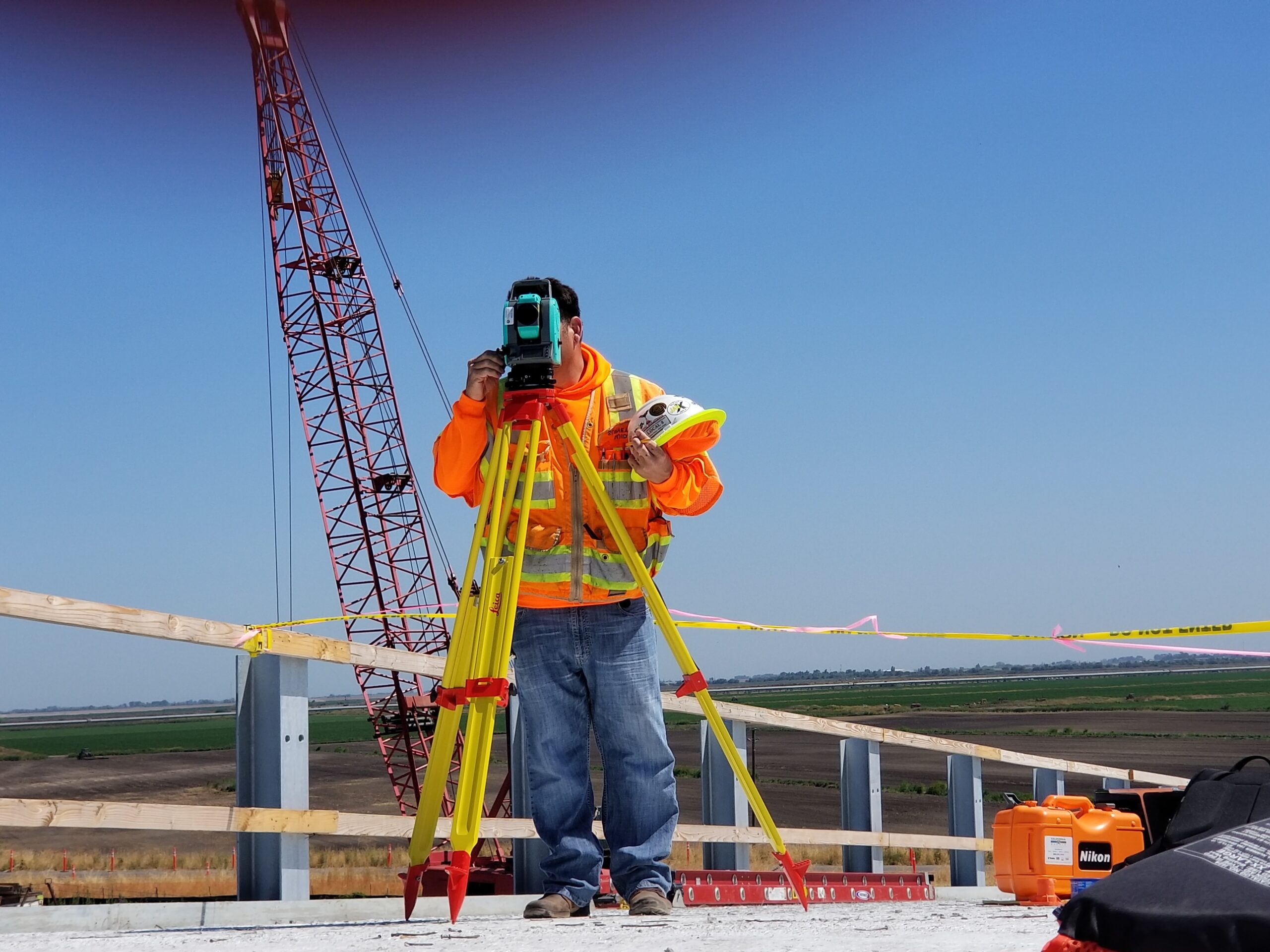
  • Total Open Station 0.4 release

    Total Open Station 0.4 release

    This article was originally published on the Total Open Station website at https://tops.iosa.it/

    After two years of slow development, I took the opportunity of some days off to finally release version 0.4, that was already available in beta since 2017.

    No open bugs were left and this release is mature enough to hit the repositories.

    Find it on PyPI at https://pypi.python.org/pypi/totalopenstation as usual.

    Windows users, please note that the TOPS-on-a-USB-stick version will have to wait a few days more, but the beta version is equally functional.

    What’s new in Total Open Station 0.4

    The new version brings read support for 4 new formats:

    • Carlson RW5
    • Leica GSI
    • Sokkia SDR33
    • Zeiss R5

    Other input formats were improved, most notably Nikon RAW.

    DXF output was improved, even though the default template is not very useful since it is based on an old need from the time when TOPS was developed day to day on archaeological excavations.

    The work behind these new formats is in part by the new contributor to the project, Damien Gaignon (find him as @psolyca on GitHub), who submitted a lot of other code and started helping with project maintenance as well. I am very happy to have Damien onboard and since my usage of TOPS is almost at zero, it’s very likely that I will hand over the development in the near future.

    The internal data structures for handling the conversion between input and output formats are completely new, and based on the Python GeoInterface abstraction offered by the pygeoif library. This allows going beyond single points to managing lines and polygons, even though no such feature is available at the moment. If you often record linear or polygonal features that you’re manually joining in the post-processing stage, think about helping TOPS development and you could get DXF or Shapefiles with the geometries ready to use (yes, Shapefile output is on our plans, too).

    There were many bugfixes, more than 100 commits, 64 by Damien Gaignon and 52 by myself (to be honest, many of my own commits are just merges!).

    This version is the last built on Python 2, and work is already ongoing towards a new version that will be based on Python 3: a more mature codebase will mean a better program, without any visible drastic change.

    Photo by Scott Blake on Unsplash

  • 13 aprile: Mapping Party a Portofino

    È il primo in Liguria: per contribuire a creare un’informazione geografica libera e fare una passeggiata all’aria aperta.

  • I rivoluzionari delle carte geografiche

    I rivoluzionari delle carte geografiche (meglio noti come OpenStreetMap) sono finiti su La Stampa di ieri a pagina 24… Grazie Edoardo!!

    OsmLaStampa
  • M(‘)appare Milano – campagna di mappatura OpenStreetMap sotto la Madonnina

    M(‘)appare Milano è la nuova iniziativa lanciata da GFOSS.it e OpenStreetMap per coinvolgere i mappatori milanesi in micro eventi della durata massima di 3 ore durante i quali si procede alla raccolta dei dati di una zona limitata di territorio. La fase di editing della mappa verrà svolta dai partecipanti al proprio domicilio.

    Lo scopo collaterale è quello di far conoscere il progetto ad altri potenziali partecipanti coinvolgendoli in una mappatura a due nella loro prima esperienza.

    Il primo Micro Mapping Party si è svolto il 2 marzo 2008 nella zona compresa tra:

    • viale Zara-Fulvio Testi
    • viale Marche
    • viale Monza
    • via Giosué Carducci a Sesto San Giovanni

    milano

    Se abiti a Milano o nei dintorni, mappa anche tu!

  • v.count.points.sh

    Last week I was looking at some slides from a lecture here at university. One slide caught my attention more than others, it was a map with some pie charts representing the distribution of different vegetal species in quadrats of an archaeological sites. Quite common and ordinary stuff in publications, indeed.

    The resulting thematic map with pie charts

    The first question rising to my mind was: how do I do this in GRASS?. It turned out that there wasn’t a module to automagically count the number of points within an area, and generate a report that keeps also information about the distribution of different classes. The chart stuff is already available since GRASS 6.0 and before, but I needed a module that could generate data from which I could plot charts.

    Thanks to Giovanni Allegri, Markus Neteler I could end up with a bash script that does all this quite well, even though a bit slowly. Hamish Bowman helped a lot pointing out some unsafe pieces of code and helping for a faster code. v.count.points.sh is now the first of a series of tutorials about spatial analysis (this being a very simple form of analysis) for archaeology on the Quantitative Archaeology wiki.

    Check out the script page on the wiki and let me know if you find errors. Patches are welcome!

  • Copyright not applicable to geodata?

    There has been some rumor on the italian GFOSS mailing list, and also on many other forums about geodata copyright issues, after this exhaustive post by Jo Walsh.

    The issue is quite simple: many open geodata advocates have been thinking for months that a good compromise for public institutions that own public geodata would have been a Creative Commons-family license. First of all, let’s be clear about Creative Commons: just talking about CC means nothing, because you should always specify which kind of licensing you intend to use for your creation.

    Our last words, creation, introduce the major problem here. Geodata are mostly factual, because there’s no creativity in them. They just describe facts, geofacts if you like. People do not create data, they just put in digital shape something that exists. Or, if you prefer, there’s no creativity in geodata, opposed to music, poetry, photography… Creative Commons, yes.

    This could mean that public geodata could only go through public domain. I have no hope for European States to choose public domain for our geodata, that have been paid with our much-suffered taxes. GFOSS will try to convince administrators to follow this innovating way.

  • satelliti geostazionari e filo interdentale

    Se decidiamo di creare una fondazione per lo sviluppo e la promozione di software e dati liberi nell’ambito geospaziale, perché non chiamarla GFLOSS?

    Semplice: perché il suo nome ricorda quello del filo interdentale.

    Comunque, il vero nome è GFOSS. Dovrebbe uscire fuori una ONLUS, o qualcosa del genere. Giusto a conferma del fatto che io sono un terzosettorista…

    Ultimamente sui blog ICT non si fa altro che parlare di Web 2.0. Forse molti nemmeno sanno cosa sia. Forse molti nemmeno si ricordano cosa fosse il Web 1.0, nessuno si ricorda di quale fosse l’utilità di Internet senza Google, senza webmail AJAX, senza blog, senza messaggistica immediata. Di recente Nature ha stabilito in una indagine che Wikipedia non è meno affidabile della ben più blasonata Encyclopædia Britannica, suscitando lo scalpore dei puritani. In effetti, stiamo assistendo alla crescita di un vero luogo di incontro. C’è una espressione, che è passata di moda ancora prima di avere un senso, ed è villaggio globale. Oggi stiamo vedendo l’alba di questo villaggio, che passa necessariamente attraverso le strane sigle i18n e l10n. Nessuno se ne rende conto, ma il 90% di quello che leggiamo sulla rete è scritto in inglese. E nonostante il nostro sistema scolastico faccia schifo per definizione, noi riusciamo a capire. Ci sono altre persone meno fortunate di noi, che l’inglese non lo sanno. E c’è chi sta lavorando per dare una chiave d’ingresso per il villaggio globale a tutte queste persone. Non c’è alternativa a Linux, se volete sapere come la penso. BSD, forse.

    gqbwiki
    Quanto sia possibile stuprare un wiki per plasmarlo ad immagine e somiglianza della propria mente, è qualcosa di cui mi sto convincendo a fondo. E siccome non sono da solo a pensarlo, sarà ben difficile fermarmi, suppongo. (Come al solito poi sarò io ad autodistruggermi nella mia vacuità).

    Alla domanda: se partissi per un’isola deserta, quale software vorresti portare con te?, la mia risposta è: Mozilla Firefox. E non dite che è l’uovo di Colombo.

    Le belle cose dell’Unione Europea: ha lanciato il sistema GALILEO che concettualmente è simile al GPS ma è estemamente più potente e preciso, e soprattutto nasce per scopi primariamente civili e non militari. Per di più, è già attualmente disponibile al pubblico il sistema EGNOS per la correzione in tempo reale dei dati GPS. In questo vedo una irragiungibile superiorità rispetto agli USA, dove il motore dell’economia è costituito dall’industria bellica.

    Le cose brutte dell’Unione Europea: a giugno se tutto procede come previsto verrà approvata la direttiva INSPIRE che sancisce il copyright di stato sui dati geografici pubblici, costringendo in breve a pagare due volte per avere qualcosa che è stato prodotto con le vostre tasse. Bello, no? In questo vedo un segno innegabile della eterna inferiorità dell’Europa nei confronti dell’America, dove i geodati e tutto ciò che viene prodotto dalle agenzie nazionali sono di pubblico dominio (secondo voi è un caso che il free software sia nato negli USA?) da sempre.

    Part of the inhumanity of the computer is that, once it is competently programmed and working smoothly, it is completely honest. – Isaac Asimov