-
Tormento
Tormento -
Open archaeology: otto anni di discussioni tra tecnica, metodologia e professione
For my non-Italian-speaking friends and readers: there is an older post in English, touching several of the topics discussed here.
Il 17 e 18 novembre ero a Paestum per il workshop “Il futuro dell’antico” organizzato dall’Associazione Nazionale Archeologi (ANA) che mi ha invitato a parlare di “Open archaeology”. I risvolti nel mondo professionale della cosiddetta (non da me) “rivoluzione” open mi interessano molto, in più non avevo mai partecipato alla Borsa Mediterranea del Turismo Archeologico (evento contenitore all’interno del quale si svolgeva il workshop) e tutto sommato mi mancava un viaggio agli estremi della logistica ferroviaria (sono passato sull’Albegna poche ore dopo la riapertura ‒ attraversando il disastro ancora nell’aria). Insomma, l’invito è stato veramente gradito.

Il logo della Borsa Mediterranea come appare sulla moquette Gli otto anni del titolo si contano a partire dal 2004. Il 2004 non è solo l’anno in cui prese vita IOSA, ma più in generale si avviò un processo di convergenza tra realtà fino a quel momento isolate che poi avrebbe condotto nel 2006 al primo workshop di Grosseto.
Con il senno di poi il mio intervento non è stato dei più comprensibili. Proverò qui a svolgere il tema in modo più articolato, riflettendo sui punti che ho affrontato.
Ho iniziato con una domanda che mi pongo da qualche tempo, riassunta così:
tecnologia + futuro = futuro migliore?
Forse è banale domandarselo. Forse è incoerente con il fatto che gran parte delle mie attività hanno a che fare con la tecnologia. Ma se guardo l’archeologia del 2012 e la confronto con quella del 2002 (c’ero già dentro… il tempo passa) o del 1992, sarei disonesto se volessi vedere un radicale miglioramento avvenuto grazie alla tecnologia:
- maggiore precisione nelle misurazioni? Certamente sì, ma il rapporto costi/benefici non è stato opportunamente preso in considerazione;
- maggiore quantità di dati raccolti? Certamente sì, ma i dati solo ora iniziano timidamente a circolare in rete, 20 anni dopo l’invenzione del web, mentre un report di scavo o un volume monografico sono immutati in forma, dimensione e fruibilità;
- maggiore qualità dei dati raccolti? Non saprei;
- migliore comunicazione al pubblico? In alcuni casi, una ristretta minoranza;
- grandi scoperte grazie alla tecnologia? Nemmeno l’ombra;
- cambiamenti di paradigma? rivoluzioni copernicane? Lasciamo perdere.
Questo non significa che dobbiamo rinunciare alla tecnologia o rifiutarla. Al contrario dobbiamo appropriarcene molto più di quanto abbiamo fatto finora, e liberarci della fascinazione che esercita. Ma andiamo con ordine.
Delicious, GeoCities e il software libero
Ho portato l’esempio dei social network come anello debole del nostro uso dei sistemi di informazione. I social network più diffusi (Facebook, Twitter, Google+ e tutti gli altri) sono al di fuori del nostro controllo. Inseriamo informazioni, aggiornamenti, foto in sistemi di cui non possediamo la chiave. Sono sistemi gratuiti: il prodotto non è il sito web usato da noi, bensì siamo noi il prodotto. Non è solo teoria catastrofista, purtroppo, come dimostrano la chiusura di GeoCities e di Delicious, tanto per fare alcuni esempi. A quando la chiusura di Facebook? Una persona qualunque può credere ingenuamente alla durata eterna di qualcosa. Un’archeologa, un archeologo no, per definizione.
Questo è importante per capire il ruolo del software libero: esistono sistemi distribuiti, cioè non centralizzati, che funzionano secondo gli stessi principi del Web. Questo blog utilizza un software (WordPress) che posso installare su altri server, anche se questo ha un costo superiore all’utilizzo di un sistema gratuito. In questa dicotomia tra “libero ma costoso” e “proprietario ma gratuito” spero si possa finalmente superare la grande confusione tra software open source e software gratuito che ancora permane.
Che sia in rete o installato sui nostri pc, il software proprietario ci priva del controllo sulle informazioni e sui dati. Ma perché siamo tanto attirati dalle novità tecnologiche?
Nuove tecnologie?
Il GIS (al singolare maschile), il 3D, le reti neurali, il laser scanning, il web semantico, i social network… tutti episodi nella grande saga delle nuove tecnologie per l’archeologia. 20 anni fa la tecnologia dell’informazione era molto meno pervasiva, l’archeologia era molto più accademica e quindi in qualche caso eravamo veramente all’avanguardia nell’adozione di nuove tecnologie. Oggi tutto è cambiato, e fa sorridere che qualcuno pensi ancora di essere innovativo perché applica, usa o sviluppa tecnologia. Peraltro un sottoinsieme della tecnologia, cioè la tecnologia dell’informazione. È ovunque, è un nervo della nostra società. Non è una scelta.
Ricollegandomi all’intervento precedente di Paolo Güll, posso dire che gli archeologi devono ancora perdere la loro innocenza nei rapporti con la tecnologia e l’informatica, ancora intrisi di feticismo, timore, ignoranza. L’archeologo facci l’archeologo, no l’informatico! sento la eco di questo disperato appello ancora pulsare parlando con tanti colleghi … e invece no, è importante capire se un sistema di gestione dei dati è appropriato o meno, e non è qualcosa che si possa decidere in poco tempo, senza pensarci, senza discuterne, senza comprendere (l’autore dell’appello rimarrà anonimo, che è meglio).
In più, mentre subiamo l’evangelizzazione dei profeti delle nuove tecnologie, possiamo fare innovazione usando vecchie tecnologie come il web per condividere dati archeologici. Potevamo farlo anche 20 anni fa, ma non ne siamo stati capaci. Di condivisione dei dati ha parlato più concretamente Gabriele Gattiglia prima di me illustrando il progetto MAPPA.
Open: cosa apriamo precisamente?
“A piece of content or data is open if anyone is free to use, reuse, and redistribute it — subject only, at most, to the requirement to attribute and/or share-alike.”
Nella Open Definition, si dice che un dato o un contenuto sono aperti se soddisfano certe condizioni. Dati. Contenuti.
Permission is hereby granted, free of charge, to any person obtaining a copy of this software and associated documentation files (the “Software”), to deal in the Software without restriction, including without limitation […]
La licenza MIT è una delle più diffuse e comprensibili licenze di software libero. L’autore che la adotti per il proprio lavoro concede a chiunque, senza specificazione di provenienza, età, professione, autorizzazioni, il permesso di copiare, modificare, redistribuire il codice sorgente senza restrizioni né limitazioni. L’unica condizione è di citare l’autore.
Queste due definizioni sono importanti perché:
- spiegano senza mezzi termini che per essere “open” dobbiamo dare qualcosa agli altri ‒ se per esempio dico di avere un “approccio open (source)” o una “filosofia open” non sto dando niente;
- spiegano che i destinatari non devono essere definiti a priori (es. gli archeologi in possesso di un certo titolo di studio), ma devono essere universali.
Un mea culpa è d’obbligo per aver contribuito alla diffusione di locuzioni (slogan?) come open archaeology senza il necessario sottotitolo: software e dati liberi. Ma purtroppo l’ambiguità della parola open è ben oltre i confini dell’archeologia e dilaga. Quello che vi chiedo è di non inventare nuovi significati di open dovunque sia coinvolta la tecnologia dell’informazione: il significato c’è, è chiaro, e contribuisce all’esistenza di cose come Wikipedia. Anche perché in caso contrario pongo una minaccia (amichevole ‒ si capisce): di perseguitare chi usa a sproposito la open archaeology pretendendo che la metta in atto veramente.
Sarei solo pedante con questo discorso (Vittorio Fronza lo avrebbe già battezzato pippone diversi paragrafi fa, a buon diritto) se non ci fosse ArcheoFOSS. Ma invece c’è. Dal 2006 abbiamo iniziato a incontrarci, raccogliendo intorno allo stesso tavolo archeologi, informatici, avvocati, economisti, studenti. All’inizio il tema era semplice e chiaro: Free software, open source e open format nei processi di ricerca archeologica (alla faccia degli acronimi). Però nel giro di due anni ci siamo trovati a parlare di:
- diritto di accesso ai dati;
- ostacoli alla circolazione delle informazioni in rete;
- proprietà intellettuale degli archeologi a contratto
Questo è accaduto per due motivi. Il primo motivo è che queste tematiche sono lo svolgimento naturale dei principi del software libero (libertà di condivisione, riconoscimento della propria opera) nel contesto dell’archeologia italiana. Il secondo motivo, più grave e tuttora in cerca di una soluzione vera, è che non esiste in Italia un’altra occasione per affrontare questi temi ‒ affrontarli davvero, non parlarne e basta. Ritengo quindi fondata la necessità del legame tra software libero e dati liberi in questo contesto (Paolo Güll dopo mi ha detto che la pensa diversamente, ma intanto Metarc usa Mediawiki, FastiOnLine è software libero dalla testa ai piedi, così come MAPPA).
L’accesso alle banche dati è diventato fondamentale anche a livello economico dopo l’introduzione dell’archeologia preventiva, perciò qualunque professionista può capire che questa battaglia (se si può chiamare così) è un obiettivo comune. Con l’introduzione del software libero nella Pubblica Amministrazione la condivisione dei dati è oggettivamente più semplice. Per i liberi professionisti e le piccole imprese (di medie e grandi non ne vedo in archeologia) si pone anche un’altra questione economica: investire sulla formazione o sui costi di licenza? E ancora, rifacendomi all’esempio dei social network, che vale però per qualunque servizio web, esternalizzare o fare rete? Mi piacerebbe, a maggior ragione nell’ambito di un incontro organizzato dall’ANA, che queste problematiche non fossero relegate alle scelte dei singoli ma affrontate collettivamente, che si tenesse conto del percorso già fatto in questi anni.
Un esempio di “open” che mi piace
L’apertura delle banche dati e del libero accesso al patrimonio informativo sui beni culturali non riguarda solo gli archeologi. Nel suo intervento Tsao Cevoli ha messo bene in evidenza come un modello sano di partecipazione alla gestione del patrimonio debba includere anche i cittadini.
Nel 2012 per la prima volta si è tenuto in Italia il concorso fotografico Wiki Loves Monuments. Il concorso è stato possibile (anche) grazie ad un accordo tra Ministero per i Beni e le Attività Culturali e Wikimedia Italia, che consentiva di fotografare liberamente i monumenti e siti archeologici che le soprintendenze segnalavano, con una particolare attenzione a quelli “minori” (con meno di 50.000 visitatori l’anno).

Anfiteatro di Capua – Nicola D’Orta – Il vincitore di Wiki Loves Monuments Italia 2012 Tutte le foto partecipanti al concorso sono state caricate su Wikimedia Commons con una licenza Creative Commons – Attribuzione – Condividi allo stesso modo (CC-BY-SA) che permette il riutilizzo senza limitazioni, a patto che si continuino a condividere i contenuti. A me questo sembra un grande esempio di “beni culturali open” in cui la rete serve a incentivare la partecipazione dei cittadini e la “appropriazione buona” dei beni culturali, con una eccezione temporanea ad una norma tra le più anacronistiche del Codice dei Beni Culturali e del Paesaggio.
Tirando le somme…
Nel 2007 avevo invitato Tsao Cevoli, presidente dell’ANA, al secondo workshop sull’archeologia e il software libero (non si chiamava ancora ArcheoFOSS), per parlare di accesso ai dati. Già allora avevamo capito che il software era necessario ma non sufficiente. Già allora avevamo capito che era fondamentale uscire dalle aule universitarie e diffondere una maggiore consapevolezza sugli strumenti e le pratiche di creazione e gestione delle informazioni. Ci siamo un po’ persi per strada e nonostante la partecipazione di professionisti e soprintendenze sia diventata un elemento costitutivo di ArcheoFOSS c’è ancora molto lavoro da fare per rendere questa consapevolezza elementare (nel senso scolastico) e universalmente diffusa.
Il bello di questo workshop è stato ritrovare lo stesso spirito di partecipazione e critica che siamo riusciti a creare in ArcheoFOSS, in una atmosfera seria ma sanamente informale (nella quale ho potuto rivendicare il diritto al mugugno all’inizio del mio intervento) . È un modo per andare dritti al sodo, senza girare intorno ai problemi.
Ho concluso più o meno così:
Io non credo nella condivisione della conoscenza come costituzione di super-intelligenze, di banche dati in grado di rispondere a tutte le domande, la conoscenza si fa costruendo e assemblando le banche dati. Spero invece che la crescente diffusione di dati archeologici in rete possa dare ‒ per dirla con Wu Ming ‒ asce di guerra alle archeologhe e agli archeologi di domani.
• · • · •
Appendice: standard e partecipazione
Sabato 17, durante la prima sessione del workshop, ho commentato l’intervento di Andrea D’Andrea sul web semantico, sottolineando che le ontologie CIDOC-CRM sono state create a tavolino da un gruppo ristretto di persone (per la gestione dei beni museali), ed è quindi difficile accettare che questi standard siano accettati da decine di migliaia di professionisti che se li vedono recapitare a scatola chiusa. È vero che CIDOC-CRM è uno standard ISO: tuttavia, mentre qualunque ingegnere impara che per certi aspetti del suo lavoro dovrà fare riferimento agli standard ISO di competenza, a nessun archeologo viene comunicata l’esistenza di questi standard, che rimangono dominio per pochi “scienziati dell’informazione” (cito D’Andrea) in grado di interagire con gli archeologi. Sono emersi anche problemi di ordine concettuale e filosofico, ma non li affronto qui. Mi è sembrato emblematico che D’Andrea stesso abbia definito “incomprensibili” alcuni dei principali concetti che tentava di esporre ‒ e che si continui a partire da concetti totalmente astratti (ontologie, modelli dati) senza riuscire ad entrare nel concreto e semplice svolgimento dei linked open data.
Ho fatto anche un incauto parallelo con lo sviluppo delle schede ICCD negli anni ’80 (a cui è seguita una opportuna correzione di Giuseppina Manca di Mores, che comunque mi è sembrata rafforzare il punto del mio discorso sull’importanza della partecipazione). L’importanza di standard costruiti tramite processi partecipativi è ritornata anche nelle discussioni di domenica e credo possa essere un punto di partenza per iniziare a confrontarsi con gli standard tecnici che già esistono in modo critico e iterativo (l’iteratività dei processi creativi mi piace molto ‒ ma ne parliamo un’altra volta), puntando alle buone pratiche.
-
Tweet dal futuro
Tutti i tweet di @stekosteko da “Il futuro dell’antico”. Con commento tecnico.
Il giorno prima
L’anteprima fa capire tutto sul seguito:
https://twitter.com/#!/stekosteko/status/269477021346828288
https://twitter.com/#!/stekosteko/status/269563885328158721
https://twitter.com/#!/stekosteko/status/269673825468284928
Sabato 17 novembre
Ho fatto una radiocronaca forsennata di tutti gli interventi. Senza risparmiare critiche.
Andrea D’Andrea
https://twitter.com/#!/stekosteko/status/269838362054123521
https://twitter.com/#!/stekosteko/status/269838639880617985
https://twitter.com/#!/stekosteko/status/269839000632688640
https://twitter.com/#!/stekosteko/status/269839498530127872
https://twitter.com/#!/stekosteko/status/269839633968410624
https://twitter.com/#!/stekosteko/status/269839862365052928
https://twitter.com/#!/stekosteko/status/269840054401253376
https://twitter.com/#!/stekosteko/status/269840380583890944
https://twitter.com/#!/stekosteko/status/269840505133731841
https://twitter.com/#!/stekosteko/status/269840708016406530
https://twitter.com/#!/stekosteko/status/269840965831884802
https://twitter.com/#!/stekosteko/status/269841119603482624
https://twitter.com/#!/stekosteko/status/269841178495696896
https://twitter.com/#!/stekosteko/status/269841352366358528
https://twitter.com/#!/stekosteko/status/269841706709557248
https://twitter.com/#!/stekosteko/status/269841983370043392
https://twitter.com/#!/stekosteko/status/269842347066552320
https://twitter.com/#!/stekosteko/status/269842524141674496
https://twitter.com/#!/stekosteko/status/269842712503648257
Massimo My
https://twitter.com/#!/stekosteko/status/269842980125425666
https://twitter.com/#!/stekosteko/status/269843192558522368
https://twitter.com/#!/stekosteko/status/269843538731229184
https://twitter.com/#!/stekosteko/status/269844000234672128
https://twitter.com/#!/stekosteko/status/269844179813818368
https://twitter.com/#!/stekosteko/status/269844794421940225
https://twitter.com/#!/stekosteko/status/269845092322402305
https://twitter.com/#!/stekosteko/status/269845880000110593
https://twitter.com/#!/stekosteko/status/269846659121434624
https://twitter.com/#!/stekosteko/status/269847137490198529
https://twitter.com/#!/stekosteko/status/269847364158750722
Paola Mazzei
https://twitter.com/#!/stekosteko/status/269847629863739392
https://twitter.com/#!/stekosteko/status/269848935982567424
https://twitter.com/#!/stekosteko/status/269849099728195584
https://twitter.com/#!/stekosteko/status/269849397054025728
https://twitter.com/#!/stekosteko/status/269849527517868032
https://twitter.com/#!/stekosteko/status/269849758464614401
https://twitter.com/#!/stekosteko/status/269850168407502849
https://twitter.com/#!/stekosteko/status/269850475485097984
https://twitter.com/#!/stekosteko/status/269850686433402882
https://twitter.com/#!/stekosteko/status/269850938334920704
https://twitter.com/#!/stekosteko/status/269851360189620225
https://twitter.com/#!/stekosteko/status/269851644169162753
https://twitter.com/#!/stekosteko/status/269851851606872064
Erik Pender
All’inizio ho scritto il nome sbagliato.
https://twitter.com/#!/stekosteko/status/269852229429776387
https://twitter.com/#!/stekosteko/status/269852552701554690
https://twitter.com/#!/stekosteko/status/269852918423908352
https://twitter.com/#!/stekosteko/status/269853092734971905
https://twitter.com/#!/stekosteko/status/269853833398738945
Mi rendo conto del typo e ho una reazione geek:
https://twitter.com/#!/stekosteko/status/269854008036966400
https://twitter.com/#!/stekosteko/status/269855535367602176
https://twitter.com/#!/stekosteko/status/269856182741630977
Astrid D’Eredità
https://twitter.com/#!/stekosteko/status/269856829616582657
https://twitter.com/#!/stekosteko/status/269858570919636992
https://twitter.com/#!/stekosteko/status/269859220311130113
https://twitter.com/#!/stekosteko/status/269859455036948480
https://twitter.com/#!/stekosteko/status/269859880976932865
https://twitter.com/#!/stekosteko/status/269860276680142849
https://twitter.com/#!/stekosteko/status/269861324144648192
https://twitter.com/#!/stekosteko/status/269861523596394497
Giorgio Troisi
In Comic Sans come il CERN.
https://twitter.com/#!/stekosteko/status/269862091534503936
https://twitter.com/#!/stekosteko/status/269862261307355137
https://twitter.com/#!/stekosteko/status/269862473119698945
https://twitter.com/#!/stekosteko/status/269862664308678656
https://twitter.com/#!/stekosteko/status/269862914654076928
https://twitter.com/#!/stekosteko/status/269863063551877120
https://twitter.com/#!/stekosteko/status/269863242736754688
https://twitter.com/#!/stekosteko/status/269863466683215872
https://twitter.com/#!/stekosteko/status/269863748167168000
https://twitter.com/#!/stekosteko/status/269863996654497792
https://twitter.com/#!/stekosteko/status/269864313148293120
https://twitter.com/#!/stekosteko/status/269864953874378755
https://twitter.com/#!/stekosteko/status/269865522013802496
https://twitter.com/#!/stekosteko/status/269865722883211265
https://twitter.com/#!/stekosteko/status/269866080640585728
https://twitter.com/#!/stekosteko/status/269866395964166145
https://twitter.com/#!/stekosteko/status/269866863360606208
Salvatore Agizza e Michele Stefanile
Ho fatto confusione tra i due per tutto l’intervento. Chiedo scusa.
https://twitter.com/#!/stekosteko/status/269867103056707585
https://twitter.com/#!/stekosteko/status/269867216730738688
https://twitter.com/#!/stekosteko/status/269868046930300928
https://twitter.com/#!/stekosteko/status/269868422496677889
https://twitter.com/#!/stekosteko/status/269868569020493824
https://twitter.com/#!/stekosteko/status/269869548948299776
Walter Grossi
https://twitter.com/#!/stekosteko/status/269873877918838785
https://twitter.com/#!/stekosteko/status/269874306635419648
https://twitter.com/#!/stekosteko/status/269874615499751424
https://twitter.com/#!/stekosteko/status/269874832554983424
https://twitter.com/#!/stekosteko/status/269875276060708865
Postumi
Il giorno successivo non ero in vena di radiocronaca, anche perché parlavo, ma qualcuno ha colto una delle cose più importanti che ho detto:
https://twitter.com/#!/stekosteko/status/271180046088151040
La notizia completa è sul sito di ArcheoFOSS.
-
Archeologia due punto zero
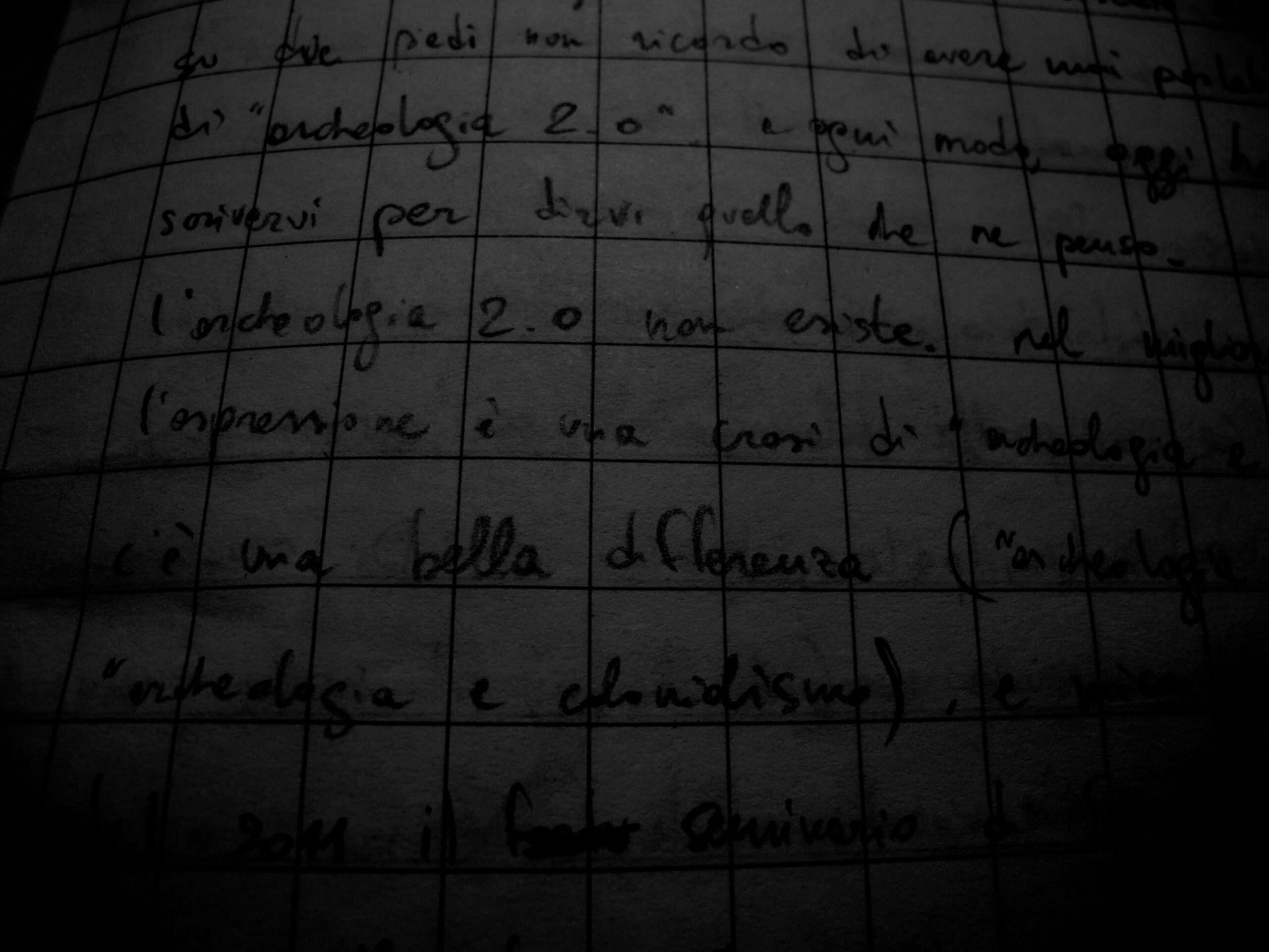
Appunti cartacei del sedici dicembre duemiladodici, in treno verso Genova e poi Roma e poi Paestum.
Può darsi che qualche volta ci sia cascato anche io, ma su due piedi non ricordo di avere mai parlato o scritto di “archeologia 2.0”. A ogni modo, oggi ho deciso di scrivervi per dirvi quello che ne penso.
L’archeologia 2.0 non esiste. Nel migliore dei casi, l’espressione è una crasi di archeologia e web 2.0. Ma c’è una bella differenza (pensate ad “archeocolonialismo” oppure “archeologia e colonialismo”) e credo non per caso nel febbraio 2011 il seminario organizzato a Siena si chiamava “Lo scavo e il web 2.0”. Ora non voglio andare contro chi ha usato questa espressione (fino a renderla il titolo di un fortunato blog), perché intendo questa riflessione anzitutto come autocritica. All’estero si studia già da qualche tempo in modo critico l’uso, l’abuso e la fascinazione morbosa dei social network nella pratica archeologica (Lorna Richardson, Dr. Web-Love). Qui forse siamo ancora alla fascinazione.
Inizio con 2 parole sul “2.0”. Nell’industria del software si usa la pratica ingegneristica di numerare le versioni che vengono rilasciate. La prima versione è (era) tipicamente la 1.0. La versione 2.0 è quindi diventata per antonomasia la “prossima”, quella “migliore di sempre” rispetto alla quale la precedente diventa obsoleta, non supportata e imbarazzante. Ci sono nuove funzioni, una migliore usabilità, etc. La trasposizione di “2.0” come aggettivo del web ha degli specifici diversi (social, user-generated content, cloud) ma permane il concetto di “rivoluzionario miglioramento”.
Non vedo rivoluzionari miglioramenti nell’archeologia, e in quella italiana in particolare. Ne ho sentito parlare, questo sì, e abbiamo avuto varie rivoluzioni annunciate, ma dopo l’annuncio niente. Forse c’è stata un po’ di confusione in un periodo (transitorio, come tanti periodi) in cui erano/eravamo in pochi a usare il web 2.0 per comunicare l’archeologia, e si è avuta l’impressione di fare la rivoluzione solo perché si usavano degli strumenti nuovi, un po’ come abbiamo fatto con il software libero (l’ho scritto all’inizio che era soprattutto autocritica). Il fatto è che l’archeologia pubblica esiste da molti decenni e da sempre ha usato i mezzi di comunicazione esistenti. Forse abbiamo assistito a un rovesciamento delle credenze popolari sugli Etruschi, sulla caduta dell’Impero Romano, sulla vita rurale nel Basso Medioevo? Abbiamo sovvertito qualcosa usando il web 2.0? Di nuovo, non mi sembra. Ma forse sto attaccandomi a dei dettagli senza andare al cuore del problema.
Magari “archeologia 2.0” è solo wishful thinking, ché sarebbe bello davvero riscrivere da capo il nostro codice e aggiornare a una nuova versione del software, dove possiamo dimenticare l’egemonia culturale dell’Università (non delle università) verso i professionisti, smettere di attaccarsi all’articolo 9 della Costituzione per difendere in realtà i diritti dei lavoratori della cultura, accettare che la cultura è di elite, rifiutare che le elite siano chiuse e poi finirla di raccontare al pubblico un passato sempre edificante, lineare. Questo elenco è destinato a essere un campionamento casuale delle tante, troppe cose che non vanno nell’archeologia italiana.
Intorno al 2006 ho detto e scritto che le rivendicazioni di specificità dell’archeologia nei confronti dell’informatica erano barzellette, perché saremo sempre costretti a usare quello che la società nel suo complesso usa. Siamo troppo pochi, troppo piccoli per essere noi a cambiare le cose. Nessun archeologo si vanta di usare l’automobile, ma quasi tutti lo fanno, quindi … Archeologia motorizzata! Ve lo immaginate? Per un breve periodo c’è stato eccitamento per la fotografia digitale (e il web 2.0 ci permette di vedere innumerevoli foto brutte, e poche foto belle che rendono ancora più brutte tutte le altre, in attesa di usare direttamente Instagram per le foto dei reperti). Ora che da qualche mese mio padre ha un account Twitter, posso mettere nel cassetto anche questa pagina della nostra gloriosa rivoluzione digitale. Eh sì, perché il punto è proprio quello, tra 2-3 anni il 2.0 sarà talmente banale…
Non c’è niente di sbagliato nel “lasciare la porta aperta” sul proprio cantiere di scavo, ma qualcuno ha davvero il tempo di seguire una ricerca senza prendervi parte, tornando a recitare il ruolo di quel “pubblico a casa”, così fuori luogo nell’epoca della partecipazione?
Da una archeologia 2.0 mi aspetto almeno che abbia perso un po’ dell’innocenza accumulata indebitamente.
-
La vita non è tutta rose e fiori

Teste di acciughe sfilettate A volte finisce male.
-

Civitates in annalibus regni Francorum
The Annales Regni Francorum are a (rather boring) official chronicle of the early Carolingians, covering the years from 741 to 829. I remember studying the historiography of this period in the two classes of Medieval Latin Literature I’ve been following in my college years. What I could not remember, however, is that the Annales cite Populonium, supposedly a settlement not far to Vignale, also known from the Late Antique Tabula Peutingeriana.
The passage is the following:
In Tuscia Populonium civitas maritima a Grecis, qui Orobiotae vocantur, depraedata est. Mauri quoque de Hispania Corsicam ingressi in ipso sancto paschali sabbato civitatem quandam diripuerunt et praeter episcopum ac paucos senes atque infirmos nihil in ea reliquerunt.

Annales Regni Francorum, an excerpt from the 1561 edition. Note the misspelling of magna for maritima, and the fine Greek typing of Οροβιῶται. It seems that Populonium was not a humble village, nor a dead city, but a civitas maritima. This small piece of history couples nicely with two documents from the year 770 that were written at the ecclesia S(an)c(t)i Uiti in Cornina, again not far from Vignale. There was a vibrant life, focused around possibly small centres, that were nevertheless part of a very large network, mostly ecclesiastical.
However, words alone do not tell a story. What was a civitas at the time of Charlemagne? Consistency isn’t perhaps the best quality of a text that could have been composed by ‘cut and paste’ during the late 9th century. On the map below are all the civitates mentioned as such in the Annales.

There are 40 civitates mentioned in the Annales. Most of them are in Italy and France, the heart of the Kingdom of the Franks, with some also in Germany, Croatia and Spain. Constantinople is a striking presence in this list, being the largest city in the world at that time (possibly together with Harun al-Rashid’s Baghdad). Therefore, it looks like size was not one of the qualifying criteria for defining a civitas. In fact, it becomes clear that they are more of a political body when we find peoples associated with a civitas, as for example the Autosiodorum civitatem where Charlemagne spent some time in the year 778 (if I am not mistaken).
So maybe it’s the episcopus who grants the title of civitas to Populonium. After all, the notion of civitas in Roman Latin is opposed to other terms defining the physical settlement such as urbs or oppidum, as in this excerpt from Rutilius Namatianus:
Agnosci nequeunt aevi monumenta prioris:
Grandia consumpsit moenia tempus edax.
Sola manent interceptis vestigia muris,
ruderibus latis tecta sepulta iacent.
Non indignemur mortalia corpora solvi:
Cernimus exemplis oppida posse mori.‒ Rutilius Namatianus, De reditu suo, I, 409-414
‒ Rutilius Namatianus, De reditu suo, I, 409-414I like to cite this passage because it refers to Populonia, the Etruscan and Roman city that ruled the same territory I am discussing. Rutilius wrote his poem in the years 415 or 417, almost four centuries earlier than the texts presented above, so no direct links are (chrono)logically allowed. Whatever happened during those four centuries is a matter for archaeological research.
The problem with archaeology is that we can assess the rough date when a villa or village were abandoned or founded, but it is more difficult to follow people when they moved, especially if the move is from larger to smaller.

Excerpt from the 19th century edition of the Annales Making the map
In the second part of this post I will describe how the above map was made, starting from the historical source.
Ingredients:
- the full Latin text from the Latin Library or Michael L. Gorodetsky‘s home page
- Pleiades places (online)
- Regnum Francorum Online (RDF dump)
- GeoNames (via geopy)
Tools:
- html2text
- Unix
grep - SpatiaLite
- QuantumGIS
- geopy
It should be clear that in the recipe there is a lot of hand-made work.
First I converted the HTML to plain text with
html2text. The resulting file, that I calledannales.txtfor convenience, was then parsed withgrepto identify all the occurrences of the term civitas. The command is:$ grep -C 1 annales.txt "civita"
and allows to match all possible variants of the word, depending on the syntactical context. From the output of
grep, I compiled by hand a list of the 40 places shown in the map. With 400, it would have been better to devise a semi-automated procedure, but in this case I preferred to concentrate on the results. A list of place-names is perfect for geocoding, except that there is no geocoding service for the 9th century! My list became a table (in a CSV file), and in a second column I added the modern name of the place, together with the country and the ZIP code to make geocoding more reliable.Enter geopy, a Python library for geocoding, that supports several backend services, including GeoNames. A short script, and we have a set of coordinates for our Early Medieval civitates, ready to fit on a map. I loaded the CSV file in QGIS, added a background from Natural Earth, tweaked the labels and the map was ready. All done? Not really.
Creating a dataset
I want to have a small but solid dataset for this map, so I thought the best thing would be to find the corresponding Pleiades place. Pleiades has a blurred definition of Antiquity, but being a derivative of the Barrington Atlas there is very little Early Medieval knowledge in it. That’s where Regnum Francorum Online (RFO) comes in: thanks to the one-to-one mapping between places in RFO and Pleiades, I could look for the corresponding Pleiades URI for most places. In some cases, this is not possible (there is no RFO nor Pleiades place for Rota and Venice, yet, but I used Torcello as a convenient compromise for the latter) or it is difficult (as in the case of Smeldingorum, to be found in Germany without a more detailed location).
Humans make mistakes. When the map was ready, I checked again that everything was in place. The combination of RFO and Pleiades was very helpful: for example, I mis-attributed Tarvisium to modern Tarvisio whereas in fact it is Treviso and I found out that Rota is not modern Roses but the smaller inland village of Roda de Ter (a detailed account of the siege is on the Catalan Viquipèdia).
Here you can find the resulting dataset in CSV: civitates-arf.csv. It is in the public domain under Creative Commons Zero.
There was an interactive map here when this article was originally published in 2012. I removed it since it didn’t work any more.
-
New Planning Policy: cambia anche l’archeologia inglese
L’archeologia italiana ha un debito nei confronti dell’archeologia inglese, maturato nel corso degli anni 1970 e ancora in crescita, anche se ad un ritmo non paragonabile a quello del periodo 1970-1990. Per questo, e forse anche per altre ragioni, quello che succede nell’archeologia inglese è importante. Oggi è successo qualcosa.
David Cameron e Nick Clegg hanno proposto una riforma della Planning Policy, cioè della legge che regola le costruzioni sul territorio. La legge attuale prevede la ricerca archeologica preventiva (la Planning Policy Guidance 16 ‒ PPG16 ‒ che nel 2010 è stata sostituita dal Planning Policy Statement 5). La riforma proposta è in pratica una deregulation, di durata limitata nel tempo che consentirebbe alle imprese costruttrici di uscire dall’attuale periodo di crisi (BBC, Guardian #1 e #2, commento negativo sul Telegraph).
Cameron ha promesso molti posti di lavoro come risultato di questa riforma, e in ogni caso i costruttori l’hanno presa bene. Gli archeologi (e non solo loro) un po’ meno, e nella giornata di oggi c’è stata una levata di scudi su Twitter, per il timore di una ulteriore perdita di posti di lavoro nell’archeologia preventiva (che già attualmente non gode di buona salute ed è sensibilmente ridotta rispetto a pochi anni fa), la possibilità che siti archeologici noti e ignoti siano messi a repentaglio dallo sviluppo incontrollato. Qui di seguito alcuni degli interventi più salienti.
https://twitter.com/lornarichardson/status/243612715095040000
https://twitter.com/lornarichardson/status/243613334878969856
https://twitter.com/lornarichardson/status/243615422803488769
So what happens to the planners, archaeologists etc who are part of the system if planning laws are relaxed? #unemployment #ShortSighted
— Alice Forward (@AliceCMForward) September 6, 2012
https://twitter.com/lornarichardson/status/243619652415135744
https://twitter.com/lornarichardson/status/243620258143932416
Urgent questions to be asked re place of archaeology in planning process when permitted development rights get extended http://t.co/ke96Nsf8
— Mike Heyworth (@mikeheyworth) September 6, 2012
Vast majority of archaeological sites rely on the planning system for protection or investigation but no Heritage Minister to fight our case
— Mike Heyworth (@mikeheyworth) September 6, 2012
https://twitter.com/lornarichardson/status/243623300423634945
I wonder how the new planning reforms will affect archaeology? http://t.co/ljbGFSjf Probably not overly good news on many aspects.
— Tom Goskar (@tomgoskar) September 6, 2012
https://twitter.com/lornarichardson/status/243630480581328897
https://twitter.com/lornarichardson/status/243630694029463552
-
L’archeologia nell’archivio Luce
9452 balli, 7700 gambe, 5608 miss, 33813 sfilate, 20451 sport, 8326 pasti … insomma, c’è veramente di tutto nei 29537 video che l’Istituto Luce ha messo a disposizione tramite YouTube. Ma quanta archeologia c’è? Senza dubbio, tantissima, vista l’importanza che l’Impero Romano e le sue vestigia hanno ricoperto per il regime fascista e non solo. Senza dimenticare l’intreccio tra archeologia e imprese coloniali nel Mediterraneo.
Quindi, sulla scia della curiosità, ho iniziato a raccogliere i video che trattano, direttamente o indirettamente, di archeologia. La playlist è questa, ma non mi risulta che sia possibile gestire collettivamente una playlist su YouTube. Allora, per mettere una pezza e fare qualcosa di più di una goccia nel mare, ho pensato che chi vuole mettere la sua “goccia” insieme alle altre può segnalare nei commenti i video che vuole segnalare per la playlist, in attesa di un sistema più smart, social, duepuntozero.
-
Total Open Station packaged for OpenSUSE
Thanks to Angelos Tzotzos (Remote Sensing Laboratory, National Technical University of Athens) Total Open Station has an installable package for OpenSUSE, since a few weeks. Installing is as easy as:
$ sudo zypper ar http://download.opensuse.org/repositories/Application:/Geo/openSUSE_12.1/ GEO
$ sudo zypper refresh
$ sudo zypper install TotalOpenStation
Any report about this package will be very welcome. We have already added these instructions in the website.
A few days ago I met Angelos in Athens. He is a very active member in several OSGeo projects and even more importantly he does an incredible job at animating the small Greek OSGeo community. I hope they will grow as our Italian community did, and I think we have an obligation to help them.


