As Lewis Binford would argue, both Roman pottery and the lonely spark plug live in the present, regardless of when they were made. Archaeologists like to think of storage buildings as “sacred” spaces of cleanliness, order and rest for the countless finds we unearth every day. That’s what manuals prescribe, so it must be like that. However, as anyone who has seen some of these rooms filled with crates and boxes knows, disorder and dirt is the rule, not the exception. There is rarely, if ever, a clear-cut separation between storage of finds and working tools, or in the best cases between storage and display. Corridors are always blocked by other crates that couldn’t find a place on the shelves. Finding where one specific crate is may take one minute, but it is always pulling it out that will keep you busy for ten or fifteen minutes. All this provided that proper archive records exist and that you can get a list of where things are, and that may prove difficult or even impossible, regardless of who is in charge of producing such a list (heck, you may be responsible in most cases). That spark plug is not there to annoy or bemuse, it is just a gentle reminder that labels and clean sherds do not stop things from happening, objects from moving (shelves collapsing, crates of any material rotting away and breaking) and people interacting with them all the time. There you have it, a storage room filled with archaeological finds is a living context, and one that should not look unfamiliar to an archaeologist.
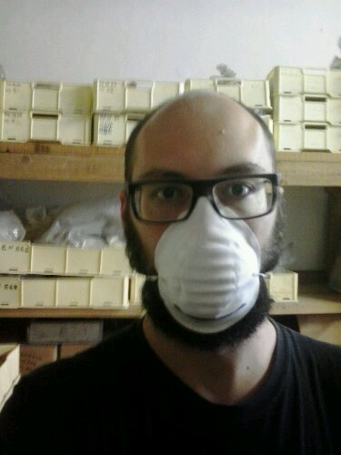
Me with a dust mask. Is that enough for punk archaeology? On the back, the usual suspect crates of finds.
Sub-optimal working conditions, uncontrolled temperature (both cold and hot), dust everywhere, need to move heavy loads: this list may be just a random sample of the small everyday glitches of archaeological fieldwork … including that of the finds specialist, and of the assistant to the finds specialist, and of the person working to keep that sacred space clean and accessible (whatever their job is called).
There is an hopefully increasing consciousness of the beauty and significance of “digging the dirt” (best exemplified by works as Between dirt and discussion by Gavin Lucas) in archaeological fieldwork. Dirt is qualifying archaeology, and attempts to leave it out of archaeological discourse are demeaning. No matter how much you clean them, potsherds are still pieces of fired clay found in the soil. Let us bring more of that consciousness out of the trenches, because in the end the substantially boring nature of our work is the same.
Crazily enough, I am discussing most of the above in my dissertation.
Mi dedico da diversi anni alla gestione delle informazioni in archeologia, anche se ultimamente mi sto interessando più agli aspetti sociali che non a quelli tecnici. In questo post parlo di ricerca archeologica ‒ ma non necessariamente ricerca universitaria ‒ e cerco di guardare all’organizzazione del lavoro di gruppo dal punto di vista dell’accesso alle informazioni. È un tema chiaramente collegato alla circolazione delle informazioni (open data, open access), ma distinto. Paradossalmente si possono verificare situazioni di diffusione esemplare verso la comunità archeologica e verso il pubblico, in cui però non corrisponde un accesso completo alle stesse informazioni all’interno del gruppo di ricerca (il paradosso piramide-cascata). La situazione opposta, appena meno paradossale, è rappresentata da gruppi in cui le informazioni circolano liberamente, ma non vengono condivise all’esterno del gruppo stesso (il paradosso “vasca dei pesci”).
Il focus implicito di quelle che scrivo qui sotto è principalmente sul fieldwork e sulle fasi successive. Anche quando siete da soli, l’archeologia è sempre un lavoro di gruppo.
Ho la fortuna di far parte di un gruppo di ricerca in cui l’accesso alle informazioni è prevalentemente orizzontale: tutti i componenti del gruppo hanno accesso alla totalità delle informazioni prodotte durante la ricerca, senza restrizioni. Tuttavia, questo gruppo di ricerca ha una struttura verticale, non particolarmente originale, con un professore universitario, alcuni assegnisti/dottorandi, qualche laureato e un certo numero variabile di studenti. Questo gruppo di ricerca è un esempio di come l’accesso alle informazioni possa essere slegato dalle strutture decisionali, con l’aiuto della rete e dell’informazione digitale. La rete aiuta molto, specialmente se le informazioni sono “nativamente” in rete come nel nostro caso. Ma la decisione di usare la rete in questo modo è una conseguenza della mentalità orizzontale di accesso alle informazioni, e ha un carattere che possiamo chiamare democratico perché pone delle condizioni uguali per tutti. Nelle giuste condizioni, ciò può risultare in un rafforzamento della coesione interna e facilitare l’inserimento di nuovi elementi nel gruppo. Questo gruppo costituisce un paradosso “vasca dei pesci” perché le informazioni sono accessibili senza filtro a tutti i componenti del gruppo di ricerca, ma non vengono diffuse all’esterno. “No sense in war, but perfect sense at home…”
Collaboro da qualche tempo con un altro gruppo di ricerca sul campo, più ampio. Questo gruppo ha una struttura verticale necessariamente più marcata, produce la maggior parte della sua documentazione su carta ed è improbabile che qualcuno dai “piani bassi” voglia o possa consultare la documentazione prodotta da altre persone di pari grado, o dai superiori. In una fase successiva, tutta la documentazione viene digitalizzata, e rimane ugualmente di difficile accesso. Vari specialisti prendono parte alla ricerca, talvolta in tempi e luoghi diversi, rimanendo di fatto invisibili se non al direttore responsabile. La maggior parte delle persone che prendono parte alla ricerca sul campo non partecipa alle successive attività, e costituiscono quindi la ”manovalanza” che ha una conoscenza molto superficiale della ricerca, sia in generale sia nel suo svolgimento.
La digitalizzazione post-scavo è ancora un momento fondamentale per la conservazione e la rielaborazione delle informazioni. Si tratta di una attività ripetitiva, che in un contesto commerciale può essere esternalizzata a costi relativamente bassi. Ho svolto questo lavoro in passato e penso che sia equivalente alla manovalanza sul campo (con il tunnel carpale in agguato in entrambi i casi). Per la natura “fordista” del data entry, è plausibile che parti diverse (ma collegate) dello stesso archivio vengano affidate a persone diverse, che quindi possono avere una immagine solo parziale di quello che stanno facendo. Si dirà che il contributo (specialmente intellettuale) di queste persone alla ricerca è pressoché nullo e non ci si debba pertanto preoccupare: io sostengo che l’accesso all’informazione digitale può apportare benefici a tutti i livelli, anche quelli più bassi, e contribuisce ad una migliore ricerca oltre che al benessere intellettuale delle persone.
La partecipazione al processo decisionale è direttamente collegata (ma non necessariamente in modo proporzionale) all’accesso alle informazioni. Come in ogni contesto sociale, l’accesso alle informazioni è una condizione essenziale per l’esercizio delle proprie funzioni e diritti. Come possiamo pretendere che uno studente partecipi a uno scavo se non gli vengono forniti gli strumenti per capire cosa sta facendo? In che modo un professionista dovrebbe lavorare sul campo se non ha accesso alla documentazione delle ricerche pregresse in una determinata area? Se queste condizioni non sono soddisfatte, prevale un processo gerarchico, in cui le istruzioni vengono dall’alto e i risultati “atomici” vengono dal basso, per essere ricomposti via via che risalgono la scala di controllo.
L’esistenza di una gerarchia verticale nella ricerca sul campo non è quasi mai messa in discussione, almeno nella mia esperienza (le origini di questa prassi si possono ricercare nelle radici militari dell’archeologia inglese, ma anche nella netta dicotomia tra archeologo e scavatore prevalente fino agli 1970 e oltre, e in definitiva si tratta di una prassi comune a quasi tutte le attività sociali). Un gruppo molto ristretto (meno di dieci persone) può “concedersi” un approccio più rilassato, ma ci saranno sempre occasioni in cui è una persona sola a decidere, anche per ragioni burocratiche e legislative: tuttavia l’effettivo processo decisionale può essere molto diverso, e può coinvolgere una proporzione più o meno ampia dell’insieme dei partecipanti sotto forma di dibattito, anche informale. Questi dibattiti possono riguardare elementi circoscritti e specifici dell’attività, oppure la strategia generale di intervento e i metodi impiegati per l’attuazione della ricerca. Io penso che si tratti di momenti fondamentali per la formazione e per la buona riuscita delle attività di ricerca archeologica a qualunque livello.
Il tema è ampio e meriterebbe una approfondita analisi, anche tramite un questionario. Per il momento mi limito ad esporre due diritti che ritengo elementari.
Ogni partecipante ad una ricerca sul campo deve avere:
diritto di accesso a tutte le informazioni prodotte dalla ricerca stessa
diritto ad una copia digitale delle informazioni che ha prodotto in prima persona o ha contribuito a produrre in modo sostanziale
Che ne dite? La vostra ricerca è democratica? Quali diritti avete? Quali diritti pretendete?
For my non-Italian-speaking friends and readers: there is an older post in English, touching several of the topics discussed here.
Il 17 e 18 novembre ero a Paestum per il workshop “Il futuro dell’antico” organizzato dall’Associazione Nazionale Archeologi (ANA) che mi ha invitato a parlare di “Open archaeology”. I risvolti nel mondo professionale della cosiddetta (non da me) “rivoluzione” open mi interessano molto, in più non avevo mai partecipato alla Borsa Mediterranea del Turismo Archeologico (evento contenitore all’interno del quale si svolgeva il workshop) e tutto sommato mi mancava un viaggio agli estremi della logistica ferroviaria (sono passato sull’Albegna poche ore dopo la riapertura ‒ attraversando il disastro ancora nell’aria). Insomma, l’invito è stato veramente gradito.
Il logo della Borsa Mediterranea come appare sulla moquette
Gli otto anni del titolo si contano a partire dal 2004. Il 2004 non è solo l’anno in cui prese vita IOSA, ma più in generale si avviò un processo di convergenza tra realtà fino a quel momento isolate che poi avrebbe condotto nel 2006 al primo workshop di Grosseto.
Con il senno di poi il mio intervento non è stato dei più comprensibili. Proverò qui a svolgere il tema in modo più articolato, riflettendo sui punti che ho affrontato.
Ho iniziato con una domanda che mi pongo da qualche tempo, riassunta così:
tecnologia + futuro = futuro migliore?
Forse è banale domandarselo. Forse è incoerente con il fatto che gran parte delle mie attività hanno a che fare con la tecnologia. Ma se guardo l’archeologia del 2012 e la confronto con quella del 2002 (c’ero già dentro… il tempo passa) o del 1992, sarei disonesto se volessi vedere un radicale miglioramento avvenuto grazie alla tecnologia:
maggiore quantità di dati raccolti? Certamente sì, ma i dati solo ora iniziano timidamente a circolare in rete, 20 anni dopo l’invenzione del web, mentre un report di scavo o un volume monografico sono immutati in forma, dimensione e fruibilità;
maggiore qualità dei dati raccolti? Non saprei;
migliore comunicazione al pubblico? In alcuni casi, una ristretta minoranza;
grandi scoperte grazie alla tecnologia? Nemmeno l’ombra;
cambiamenti di paradigma? rivoluzioni copernicane? Lasciamo perdere.
Questo non significa che dobbiamo rinunciare alla tecnologia o rifiutarla. Al contrario dobbiamo appropriarcene molto più di quanto abbiamo fatto finora, e liberarci della fascinazione che esercita. Ma andiamo con ordine.
Delicious, GeoCities e il software libero
Ho portato l’esempio dei social network come anello debole del nostro uso dei sistemi di informazione. I social network più diffusi (Facebook, Twitter, Google+ e tutti gli altri) sono al di fuori del nostro controllo. Inseriamo informazioni, aggiornamenti, foto in sistemi di cui non possediamo la chiave. Sono sistemi gratuiti: il prodotto non è il sito web usato da noi, bensì siamo noi il prodotto. Non è solo teoria catastrofista, purtroppo, come dimostrano la chiusura di GeoCities e di Delicious, tanto per fare alcuni esempi. A quando la chiusura di Facebook? Una persona qualunque può credere ingenuamente alla durata eterna di qualcosa. Un’archeologa, un archeologo no, per definizione.
Questo è importante per capire il ruolo del software libero: esistono sistemi distribuiti, cioè non centralizzati, che funzionano secondo gli stessi principi del Web. Questo blog utilizza un software (WordPress) che posso installare su altri server, anche se questo ha un costo superiore all’utilizzo di un sistema gratuito. In questa dicotomia tra “libero ma costoso” e “proprietario ma gratuito” spero si possa finalmente superare la grande confusione tra software open source e software gratuito che ancora permane.
Che sia in rete o installato sui nostri pc, il software proprietario ci priva del controllo sulle informazioni e sui dati. Ma perché siamo tanto attirati dalle novità tecnologiche?
Nuove tecnologie?
Il GIS (al singolare maschile), il 3D, le reti neurali, il laser scanning, il web semantico, i social network… tutti episodi nella grande saga delle nuove tecnologie per l’archeologia. 20 anni fa la tecnologia dell’informazione era molto meno pervasiva, l’archeologia era molto più accademica e quindi in qualche caso eravamo veramente all’avanguardia nell’adozione di nuove tecnologie. Oggi tutto è cambiato, e fa sorridere che qualcuno pensi ancora di essere innovativo perché applica, usa o sviluppa tecnologia. Peraltro un sottoinsieme della tecnologia, cioè la tecnologia dell’informazione. È ovunque, è un nervo della nostra società. Non è una scelta.
Ricollegandomi all’intervento precedente di Paolo Güll, posso dire che gli archeologi devono ancora perdere la loro innocenza nei rapporti con la tecnologia e l’informatica, ancora intrisi di feticismo, timore, ignoranza. L’archeologo facci l’archeologo, no l’informatico! sento la eco di questo disperato appello ancora pulsare parlando con tanti colleghi … e invece no, è importante capire se un sistema di gestione dei dati è appropriato o meno, e non è qualcosa che si possa decidere in poco tempo, senza pensarci, senza discuterne, senza comprendere (l’autore dell’appello rimarrà anonimo, che è meglio).
In più, mentre subiamo l’evangelizzazione dei profeti delle nuove tecnologie, possiamo fare innovazione usando vecchie tecnologie come il web per condividere dati archeologici. Potevamo farlo anche 20 anni fa, ma non ne siamo stati capaci. Di condivisione dei dati ha parlato più concretamente Gabriele Gattiglia prima di me illustrando il progetto MAPPA.
Open: cosa apriamo precisamente?
“A piece of content or data is open if anyone is free to use, reuse, and redistribute it — subject only, at most, to the requirement to attribute and/or share-alike.”
Nella Open Definition, si dice che un dato o un contenuto sono aperti se soddisfano certe condizioni. Dati. Contenuti.
Permission is hereby granted, free of charge, to any person obtaining a copy of this software and associated documentation files (the “Software”), to deal in the Software without restriction, including without limitation […]
La licenza MIT è una delle più diffuse e comprensibili licenze di software libero. L’autore che la adotti per il proprio lavoro concede a chiunque, senza specificazione di provenienza, età, professione, autorizzazioni, il permesso di copiare, modificare, redistribuire il codice sorgente senza restrizioni né limitazioni. L’unica condizione è di citare l’autore.
Queste due definizioni sono importanti perché:
spiegano senza mezzi termini che per essere “open” dobbiamo dare qualcosa agli altri ‒ se per esempio dico di avere un “approccio open (source)” o una “filosofia open” non sto dando niente;
spiegano che i destinatari non devono essere definiti a priori (es. gli archeologi in possesso di un certo titolo di studio), ma devono essere universali.
Un mea culpa è d’obbligo per aver contribuito alla diffusione di locuzioni (slogan?) come open archaeology senza il necessario sottotitolo: software e dati liberi. Ma purtroppo l’ambiguità della parola open è ben oltre i confini dell’archeologia e dilaga. Quello che vi chiedo è di non inventare nuovi significati di open dovunque sia coinvolta la tecnologia dell’informazione: il significato c’è, è chiaro, e contribuisce all’esistenza di cose come Wikipedia. Anche perché in caso contrario pongo una minaccia (amichevole ‒ si capisce): di perseguitare chi usa a sproposito la open archaeology pretendendo che la metta in atto veramente.
Sarei solo pedante con questo discorso (Vittorio Fronza lo avrebbe già battezzato pippone diversi paragrafi fa, a buon diritto) se non ci fosse ArcheoFOSS. Ma invece c’è. Dal 2006 abbiamo iniziato a incontrarci, raccogliendo intorno allo stesso tavolo archeologi, informatici, avvocati, economisti, studenti. All’inizio il tema era semplice e chiaro: Free software, open source e open format nei processi di ricerca archeologica (alla faccia degli acronimi). Però nel giro di due anni ci siamo trovati a parlare di:
diritto di accesso ai dati;
ostacoli alla circolazione delle informazioni in rete;
proprietà intellettuale degli archeologi a contratto
Questo è accaduto per due motivi. Il primo motivo è che queste tematiche sono lo svolgimento naturale dei principi del software libero (libertà di condivisione, riconoscimento della propria opera) nel contesto dell’archeologia italiana. Il secondo motivo, più grave e tuttora in cerca di una soluzione vera, è che non esiste in Italia un’altra occasione per affrontare questi temi ‒ affrontarli davvero, non parlarne e basta. Ritengo quindi fondata la necessità del legame tra software libero e dati liberi in questo contesto (Paolo Güll dopo mi ha detto che la pensa diversamente, ma intanto Metarc usa Mediawiki, FastiOnLine è software libero dalla testa ai piedi, così come MAPPA).
L’accesso alle banche dati è diventato fondamentale anche a livello economico dopo l’introduzione dell’archeologia preventiva, perciò qualunque professionista può capire che questa battaglia (se si può chiamare così) è un obiettivo comune. Con l’introduzione del software libero nella Pubblica Amministrazione la condivisione dei dati è oggettivamente più semplice. Per i liberi professionisti e le piccole imprese (di medie e grandi non ne vedo in archeologia) si pone anche un’altra questione economica: investire sulla formazione o sui costi di licenza? E ancora, rifacendomi all’esempio dei social network, che vale però per qualunque servizio web, esternalizzare o fare rete? Mi piacerebbe, a maggior ragione nell’ambito di un incontro organizzato dall’ANA, che queste problematiche non fossero relegate alle scelte dei singoli ma affrontate collettivamente, che si tenesse conto del percorso già fatto in questi anni.
Un esempio di “open” che mi piace
L’apertura delle banche dati e del libero accesso al patrimonio informativo sui beni culturali non riguarda solo gli archeologi. Nel suo intervento Tsao Cevoli ha messo bene in evidenza come un modello sano di partecipazione alla gestione del patrimonio debba includere anche i cittadini.
Nel 2012 per la prima volta si è tenuto in Italia il concorso fotografico Wiki Loves Monuments. Il concorso è stato possibile (anche) grazie ad un accordo tra Ministero per i Beni e le Attività Culturali e Wikimedia Italia, che consentiva di fotografare liberamente i monumenti e siti archeologici che le soprintendenze segnalavano, con una particolare attenzione a quelli “minori” (con meno di 50.000 visitatori l’anno).
Anfiteatro di Capua – Nicola D’Orta – Il vincitore di Wiki Loves Monuments Italia 2012
Tutte le foto partecipanti al concorso sono state caricate su Wikimedia Commons con una licenza Creative Commons – Attribuzione – Condividi allo stesso modo (CC-BY-SA) che permette il riutilizzo senza limitazioni, a patto che si continuino a condividere i contenuti. A me questo sembra un grande esempio di “beni culturali open” in cui la rete serve a incentivare la partecipazione dei cittadini e la “appropriazione buona” dei beni culturali, con una eccezione temporanea ad una norma tra le più anacronistiche del Codice dei Beni Culturali e del Paesaggio.
Tirando le somme…
Nel 2007 avevo invitato Tsao Cevoli, presidente dell’ANA, al secondo workshop sull’archeologia e il software libero (non si chiamava ancora ArcheoFOSS), per parlare di accesso ai dati. Già allora avevamo capito che il software era necessario ma non sufficiente. Già allora avevamo capito che era fondamentale uscire dalle aule universitarie e diffondere una maggiore consapevolezza sugli strumenti e le pratiche di creazione e gestione delle informazioni. Ci siamo un po’ persi per strada e nonostante la partecipazione di professionisti e soprintendenze sia diventata un elemento costitutivo di ArcheoFOSS c’è ancora molto lavoro da fare per rendere questa consapevolezza elementare (nel senso scolastico) e universalmente diffusa.
Il bello di questo workshop è stato ritrovare lo stesso spirito di partecipazione e critica che siamo riusciti a creare in ArcheoFOSS, in una atmosfera seria ma sanamente informale (nella quale ho potuto rivendicare il diritto al mugugno all’inizio del mio intervento) . È un modo per andare dritti al sodo, senza girare intorno ai problemi.
Ho concluso più o meno così:
Io non credo nella condivisione della conoscenza come costituzione di super-intelligenze, di banche dati in grado di rispondere a tutte le domande, la conoscenza si fa costruendo e assemblando le banche dati. Spero invece che la crescente diffusione di dati archeologici in rete possa dare ‒ per dirla con Wu Ming ‒ asce di guerra alle archeologhe e agli archeologi di domani.
• · • · •
Appendice: standard e partecipazione
Sabato 17, durante la prima sessione del workshop, ho commentato l’intervento di Andrea D’Andrea sul web semantico, sottolineando che le ontologie CIDOC-CRM sono state create a tavolino da un gruppo ristretto di persone (per la gestione dei beni museali), ed è quindi difficile accettare che questi standard siano accettati da decine di migliaia di professionisti che se li vedono recapitare a scatola chiusa. È vero che CIDOC-CRM è uno standard ISO: tuttavia, mentre qualunque ingegnere impara che per certi aspetti del suo lavoro dovrà fare riferimento agli standard ISO di competenza, a nessun archeologo viene comunicata l’esistenza di questi standard, che rimangono dominio per pochi “scienziati dell’informazione” (cito D’Andrea) in grado di interagire con gli archeologi. Sono emersi anche problemi di ordine concettuale e filosofico, ma non li affronto qui. Mi è sembrato emblematico che D’Andrea stesso abbia definito “incomprensibili” alcuni dei principali concetti che tentava di esporre ‒ e che si continui a partire da concetti totalmente astratti (ontologie, modelli dati) senza riuscire ad entrare nel concreto e semplice svolgimento dei linked open data.
Ho fatto anche un incauto parallelo con lo sviluppo delle schede ICCD negli anni ’80 (a cui è seguita una opportuna correzione di Giuseppina Manca di Mores, che comunque mi è sembrata rafforzare il punto del mio discorso sull’importanza della partecipazione). L’importanza di standard costruiti tramite processi partecipativi è ritornata anche nelle discussioni di domenica e credo possa essere un punto di partenza per iniziare a confrontarsi con gli standard tecnici che già esistono in modo critico e iterativo (l’iteratività dei processi creativi mi piace molto ‒ ma ne parliamo un’altra volta), puntando alle buone pratiche.
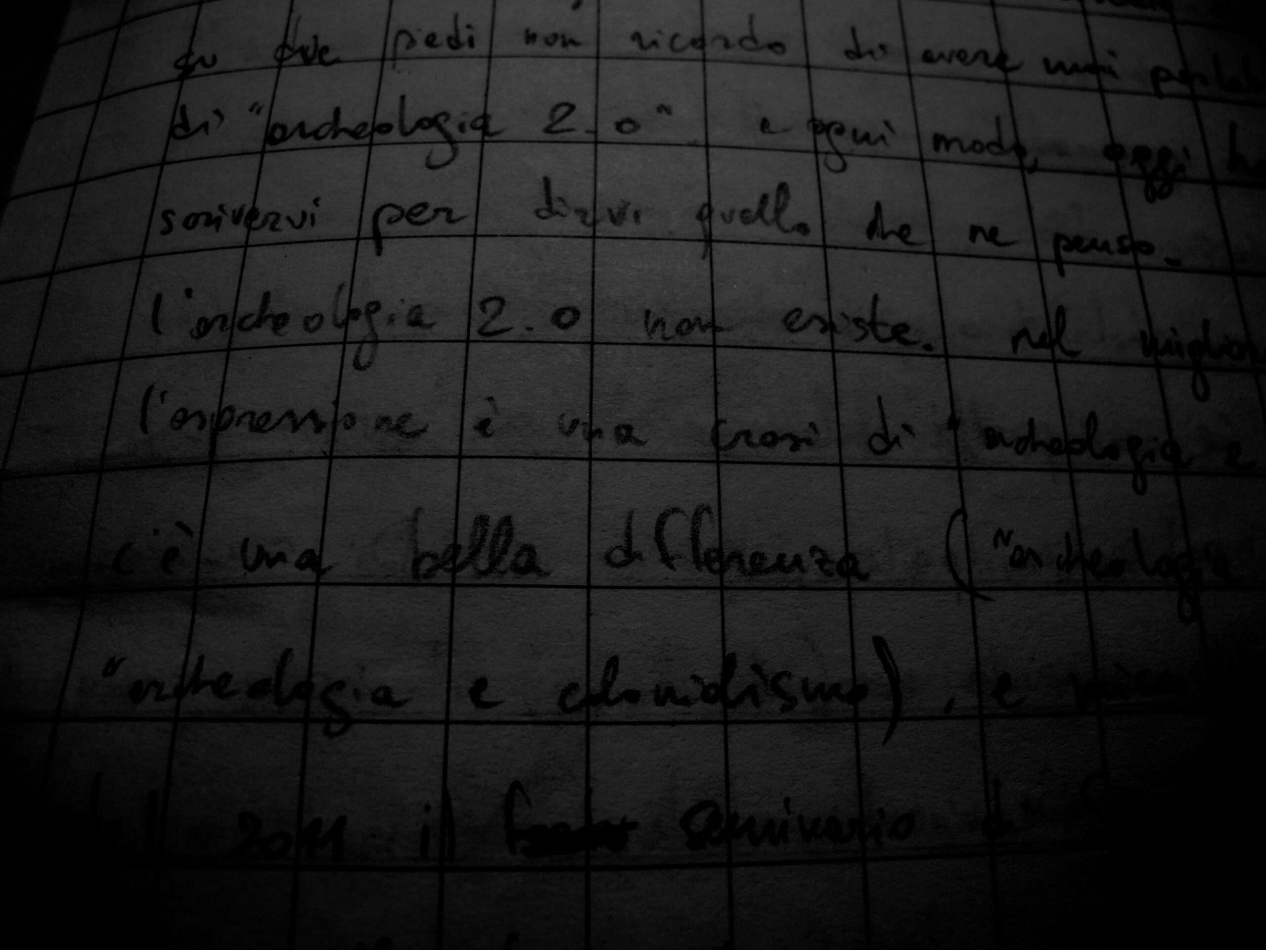
Appunti cartacei del sedici dicembre duemiladodici, in treno verso Genova e poi Roma e poi Paestum.
Può darsi che qualche volta ci sia cascato anche io, ma su due piedi non ricordo di avere mai parlato o scritto di “archeologia 2.0”. A ogni modo, oggi ho deciso di scrivervi per dirvi quello che ne penso.
L’archeologia 2.0 non esiste. Nel migliore dei casi, l’espressione è una crasi di archeologia e web 2.0. Ma c’è una bella differenza (pensate ad “archeocolonialismo” oppure “archeologia e colonialismo”) e credo non per caso nel febbraio 2011 il seminario organizzato a Siena si chiamava “Lo scavo e il web 2.0”. Ora non voglio andare contro chi ha usato questa espressione (fino a renderla il titolo di un fortunato blog), perché intendo questa riflessione anzitutto come autocritica. All’estero si studia già da qualche tempo in modo critico l’uso, l’abuso e la fascinazione morbosa dei social network nella pratica archeologica (Lorna Richardson, Dr. Web-Love). Qui forse siamo ancora alla fascinazione.
Inizio con 2 parole sul “2.0”. Nell’industria del software si usa la pratica ingegneristica di numerare le versioni che vengono rilasciate. La prima versione è (era) tipicamente la 1.0. La versione 2.0 è quindi diventata per antonomasia la “prossima”, quella “migliore di sempre” rispetto alla quale la precedente diventa obsoleta, non supportata e imbarazzante. Ci sono nuove funzioni, una migliore usabilità, etc. La trasposizione di “2.0” come aggettivo del web ha degli specifici diversi (social, user-generated content, cloud) ma permane il concetto di “rivoluzionario miglioramento”.
Non vedo rivoluzionari miglioramenti nell’archeologia, e in quella italiana in particolare. Ne ho sentito parlare, questo sì, e abbiamo avuto varie rivoluzioni annunciate, ma dopo l’annuncio niente. Forse c’è stata un po’ di confusione in un periodo (transitorio, come tanti periodi) in cui erano/eravamo in pochi a usare il web 2.0 per comunicare l’archeologia, e si è avuta l’impressione di fare la rivoluzione solo perché si usavano degli strumenti nuovi, un po’ come abbiamo fatto con il software libero (l’ho scritto all’inizio che era soprattutto autocritica). Il fatto è che l’archeologia pubblica esiste da molti decenni e da sempre ha usato i mezzi di comunicazione esistenti. Forse abbiamo assistito a un rovesciamento delle credenze popolari sugli Etruschi, sulla caduta dell’Impero Romano, sulla vita rurale nel Basso Medioevo? Abbiamo sovvertito qualcosa usando il web 2.0? Di nuovo, non mi sembra. Ma forse sto attaccandomi a dei dettagli senza andare al cuore del problema.
Magari “archeologia 2.0” è solo wishful thinking, ché sarebbe bello davvero riscrivere da capo il nostro codice e aggiornare a una nuova versione del software, dove possiamo dimenticare l’egemonia culturale dell’Università (non delle università) verso i professionisti, smettere di attaccarsi all’articolo 9 della Costituzione per difendere in realtà i diritti dei lavoratori della cultura, accettare che la cultura è di elite, rifiutare che le elite siano chiuse e poi finirla di raccontare al pubblico un passato sempre edificante, lineare. Questo elenco è destinato a essere un campionamento casuale delle tante, troppe cose che non vanno nell’archeologia italiana.
Intorno al 2006 ho detto e scritto che le rivendicazioni di specificità dell’archeologia nei confronti dell’informatica erano barzellette, perché saremo sempre costretti a usare quello che la società nel suo complesso usa. Siamo troppo pochi, troppo piccoli per essere noi a cambiare le cose. Nessun archeologo si vanta di usare l’automobile, ma quasi tutti lo fanno, quindi … Archeologia motorizzata! Ve lo immaginate? Per un breve periodo c’è stato eccitamento per la fotografia digitale (e il web 2.0 ci permette di vedere innumerevoli foto brutte, e poche foto belle che rendono ancora più brutte tutte le altre, in attesa di usare direttamente Instagram per le foto dei reperti). Ora che da qualche mese mio padre ha un account Twitter, posso mettere nel cassetto anche questa pagina della nostra gloriosa rivoluzione digitale. Eh sì, perché il punto è proprio quello, tra 2-3 anni il 2.0 sarà talmente banale…
Non c’è niente di sbagliato nel “lasciare la porta aperta” sul proprio cantiere di scavo, ma qualcuno ha davvero il tempo di seguire una ricerca senza prendervi parte, tornando a recitare il ruolo di quel “pubblico a casa”, così fuori luogo nell’epoca della partecipazione?
Da una archeologia 2.0 mi aspetto almeno che abbia perso un po’ dell’innocenza accumulata indebitamente.
The Annales Regni Francorum are a (rather boring) official chronicle of the early Carolingians, covering the years from 741 to 829. I remember studying the historiography of this period in the two classes of Medieval Latin Literature I’ve been following in my college years. What I could not remember, however, is that the Annales cite Populonium, supposedly a settlement not far to Vignale, also known from the Late Antique Tabula Peutingeriana.
The passage is the following:
In Tuscia Populonium civitas maritima a Grecis, qui Orobiotae vocantur, depraedata est. Mauri quoque de Hispania Corsicam ingressi in ipso sancto paschali sabbato civitatem quandam diripuerunt et praeter episcopum ac paucos senes atque infirmos nihil in ea reliquerunt.
Annales Regni Francorum, an excerpt from the 1561 edition. Note the misspelling of magna for maritima, and the fine Greek typing of Οροβιῶται.
It seems that Populonium was not a humble village, nor a dead city, but a civitas maritima. This small piece of history couples nicely with twodocuments from the year 770 that were written at the ecclesia S(an)c(t)i Uiti in Cornina, again not far from Vignale. There was a vibrant life, focused around possibly small centres, that were nevertheless part of a very large network, mostly ecclesiastical.
However, words alone do not tell a story. What was a civitas at the time of Charlemagne? Consistency isn’t perhaps the best quality of a text that could have been composed by ‘cut and paste’ during the late 9th century. On the map below are all the civitates mentioned as such in the Annales.
There are 40 civitates mentioned in the Annales. Most of them are in Italy and France, the heart of the Kingdom of the Franks, with some also in Germany, Croatia and Spain. Constantinople is a striking presence in this list, being the largest city in the world at that time (possibly together with Harun al-Rashid’s Baghdad). Therefore, it looks like size was not one of the qualifying criteria for defining a civitas. In fact, it becomes clear that they are more of a political body when we find peoples associated with a civitas, as for example the Autosiodorum civitatem where Charlemagne spent some time in the year 778 (if I am not mistaken).
So maybe it’s the episcopus who grants the title of civitas to Populonium. After all, the notion of civitas in Roman Latin is opposed to other terms defining the physical settlement such as urbs or oppidum, as in this excerpt from Rutilius Namatianus:
Agnosci nequeunt aevi monumenta prioris: Grandia consumpsit moenia tempus edax. Sola manent interceptis vestigia muris, ruderibus latis tecta sepulta iacent. Non indignemur mortalia corpora solvi: Cernimus exemplis oppida posse mori.
‒ Rutilius Namatianus, De reditu suo, I, 409-414
‒ Rutilius Namatianus, De reditu suo, I, 409-414
I like to cite this passage because it refers to Populonia, the Etruscan and Roman city that ruled the same territory I am discussing. Rutilius wrote his poem in the years 415 or 417, almost four centuries earlier than the texts presented above, so no direct links are (chrono)logically allowed. Whatever happened during those four centuries is a matter for archaeological research.
The problem with archaeology is that we can assess the rough date when a villa or village were abandoned or founded, but it is more difficult to follow people when they moved, especially if the move is from larger to smaller.
It should be clear that in the recipe there is a lot of hand-made work.
First I converted the HTML to plain text with html2text. The resulting file, that I called annales.txt for convenience, was then parsed with grep to identify all the occurrences of the term civitas. The command is:
$ grep -C 1 annales.txt "civita"
and allows to match all possible variants of the word, depending on the syntactical context. From the output of grep, I compiled by hand a list of the 40 places shown in the map. With 400, it would have been better to devise a semi-automated procedure, but in this case I preferred to concentrate on the results. A list of place-names is perfect for geocoding, except that there is no geocoding service for the 9th century! My list became a table (in a CSV file), and in a second column I added the modern name of the place, together with the country and the ZIP code to make geocoding more reliable.
Enter geopy, a Python library for geocoding, that supports several backend services, including GeoNames. A short script, and we have a set of coordinates for our Early Medieval civitates, ready to fit on a map. I loaded the CSV file in QGIS, added a background from Natural Earth, tweaked the labels and the map was ready. All done? Not really.
Creating a dataset
I want to have a small but solid dataset for this map, so I thought the best thing would be to find the corresponding Pleiades place. Pleiades has a blurred definition of Antiquity, but being a derivative of the Barrington Atlas there is very little Early Medieval knowledge in it. That’s where Regnum Francorum Online (RFO) comes in: thanks to the one-to-one mapping between places in RFO and Pleiades, I could look for the corresponding Pleiades URI for most places. In some cases, this is not possible (there is no RFO nor Pleiades place for Rota and Venice, yet, but I used Torcello as a convenient compromise for the latter) or it is difficult (as in the case of Smeldingorum, to be found in Germany without a more detailed location).
Humans make mistakes. When the map was ready, I checked again that everything was in place. The combination of RFO and Pleiades was very helpful: for example, I mis-attributed Tarvisium to modern Tarvisio whereas in fact it is Treviso and I found out that Rota is not modern Roses but the smaller inland village of Roda de Ter (a detailed account of the siege is on the Catalan Viquipèdia).
L’archeologia italiana ha un debito nei confronti dell’archeologia inglese, maturato nel corso degli anni 1970 e ancora in crescita, anche se ad un ritmo non paragonabile a quello del periodo 1970-1990. Per questo, e forse anche per altre ragioni, quello che succede nell’archeologia inglese è importante. Oggi è successo qualcosa.
David Cameron e Nick Clegg hanno proposto una riforma della Planning Policy, cioè della legge che regola le costruzioni sul territorio. La legge attuale prevede la ricerca archeologica preventiva (la Planning Policy Guidance 16 ‒ PPG16 ‒ che nel 2010 è stata sostituita dal Planning Policy Statement 5). La riforma proposta è in pratica una deregulation, di durata limitata nel tempo che consentirebbe alle imprese costruttrici di uscire dall’attuale periodo di crisi (BBC, Guardian #1 e #2, commento negativo sul Telegraph).
Cameron ha promesso molti posti di lavoro come risultato di questa riforma, e in ogni caso i costruttori l’hanno presa bene. Gli archeologi (e non solo loro) un po’ meno, e nella giornata di oggi c’è stata una levata di scudi su Twitter, per il timore di una ulteriore perdita di posti di lavoro nell’archeologia preventiva (che già attualmente non gode di buona salute ed è sensibilmente ridotta rispetto a pochi anni fa), la possibilità che siti archeologici noti e ignoti siano messi a repentaglio dallo sviluppo incontrollato. Qui di seguito alcuni degli interventi più salienti.
9452 balli, 7700 gambe, 5608 miss, 33813 sfilate, 20451 sport, 8326 pasti … insomma, c’è veramente di tutto nei 29537 video che l’Istituto Luce ha messo a disposizione tramite YouTube. Ma quanta archeologia c’è? Senza dubbio, tantissima, vista l’importanza che l’Impero Romano e le sue vestigia hanno ricoperto per il regime fascista e non solo. Senza dimenticare l’intreccio tra archeologia e imprese coloniali nel Mediterraneo.
Quindi, sulla scia della curiosità, ho iniziato a raccogliere i video che trattano, direttamente o indirettamente, di archeologia. La playlist è questa, ma non mi risulta che sia possibile gestire collettivamente una playlist su YouTube. Allora, per mettere una pezza e fare qualcosa di più di una goccia nel mare, ho pensato che chi vuole mettere la sua “goccia” insieme alle altre può segnalare nei commenti i video che vuole segnalare per la playlist, in attesa di un sistema più smart, social, duepuntozero.
I am currently based in Amsterdam until sometime in mid-2012, but in February I have been in Athens for ten days, doing a few interesting things.
During the first weekend of February I’ve been attending the First Workshop on Levantine Ceramic Production and Distribution, organised at the Danish Institute of Archaeology in Athens. It has been incredibly interesting, first and foremost because bringing together ceramic specialists from the Bronze Age to the Ottoman period is priceless: the patterns of raw source materials, regional geology, spatial distribution of workshops, archaeological investigation of wares and fabrics are only artificially divided into rigid chronological grids and, for once at least, it was clear to everybody that it’s necessary to go beyond closed gardens in favour of a true longue durée (that was actually called for by the organisers on the workshop website).
The workshop flyer
The Athens workshop was the first one in a series. Future workshops will take place once a year in different places.
Instead of presenting notes from each talk, I have gone a bit further, summarising the topics that I found most interesting. I hope this results in a more readable account of the workshop.
Wares
This section comprises summaries about some specific wares, based on all the presentations and the following discussion.
Fine tablewares of the Hellenistic period
Eastern Sigillata A (ESA) is the most prominent fine tableware in the (Northern) Levant in the Late Hellenistic and Early Roman periods, and it is widely found at Mediterranean sites in a much broader area. However, it is not alone. There is a variety of less widespread wares that share a lot in common with ESA.
The so-called Black-Slipped Predecessor (BSP) is an earlier production than ESA, but there is a significant continuum between the late types of BSP and some early types of ESA that were fired in a reducing atmosphere, therefore black-slipped rather than red, and there is also evidence for half-red and half-black pieces resulting either from experiments or uneven firing conditions. However, there are differences in the manufacturing of the two, e.g. in how the slip is applied to the ceramic body: while BSP follows the standard Hellenistic approach of painting only the visible parts of the surface, ESA pieces were completely dipped in the slip-paint.
Regional wares in the Levant include the Northern Coastal Fine (NCF), the Dry Red-Slipped (DRS) and Dry Brown-Slipped (DBS) and the Brown-Slipped. The classification of some or all of these wares is problematic, especially based on macroscopic observations of fabric, slip colour, surface treatment and finish.
Petrographic and chemical analysis bring more data to facilitate a classification, but they are not always consistent between each other, and neither with the macroscopic classification, which is however a necessary first step.
In Kinet-Höyük, for example, the 6 fabrics identified at a macroscopic level show little or no differences when analysed by petrographic means: there is no distinction between ESA and local tablewares (DRS, DBS). Results of neutron activation analysis (NAA) are consistent with this lack of distinction in the chemical composition of the various wares, but highlight differences in their homogeneity. BSP is for example less homogeneous, while ESA is at the other end of the spectrum being the group with less internal variability. Whether the degree of chemical homogeneity can be traced to the degree of standardisation in the production of these wares is a matter of debate. With regard to homogeneity, it should also be emphasised that it is generally invisible to the naked eye, and therefore it would have no meaning to the consumers of such products.
Brittle Wares
The definition of Brittle Ware is usually reserved to the cooking, and more generally kitchen ware of Syria. The term is however not more suitable for the Syrian cooking ware than for other Levantine wares, which are sometimes thinner. It’s therefore advisable to speak of Brittle Wares in a more general fashion. There is for example a possible local production of Brittle Ware in Kinet-Höyük.
Syrian Brittle Ware has specific types and fabrics, made in few workshops or production areas, and illustrated by a series of standard shapes mainly distributed in Syria (including Southern Anatolia and Southern Syria).
There are different levels of information about Syrian Brittle Ware, resulting from the different degree of detail is has received at the sites where is was found. The most important sites, for which there is a large corpus of samples, are a small number: Apamea, Andarin, Dibsi Faraj, Hadir, Qalat Semaan. A distinction of the fabrics and of separate workshops is necessarily based on a combination of chemical, petrographic and binocular analysis, in a continuous integration among them. Furthermore, combining fabric analysis and distribution patterns of shapes has given an insight of the location of the production areas.
Based on fabric analysis, four main production areas were identified among a larger number. These workshops ‒ or clusters of workshops ‒ are not all active at the same time; some are short living and some last for a long period. These four groups are:
Group 1: 1st-10th AD, from Antioch;
Group 3: 1st-5th, from the Euphrates region;
Group 5 (or 4?): 1st-14th, from Apamea;
Group 6: Early Islamic-Byzantine, has a highly chromed fabric.
From the study of distribution patterns, it can be seen that the further from the production centre Brittle Ware goes, the lower the variability is in the distributed forms (i.e. standardised cooking sets travel farthest).
Late Roman Amphora 1
Late Roman Amphora 1 (LRA1) is a transport amphora made in Cilicia, Cyprus and other parts of the Levant. A first survey of 13 kiln sites for this type was published in 1989 by Empereur and Picon, but it’s now outdated and it should include not only more sites but also other regions like the Dodecanese and Egypt.
A number of workshops and kilns have been studied recently, including Elaiussa Sebaste, Sole-Pompeiopolis (Cilicia), Paphos, Zygi and Amathous (Cyprus). These workshops provide a more solid basis for the definition of fabric groups rather than finds from consumption sites. In Paphos and Amathous, the LRA13 type was produced at the same kilns.
However, there are more fabric groups that are still unidentified, like the so-called “X fabric” (not to be confused with “workshop X” producing cooking pots, mentioned below), and as a result the correspondence between kiln sites and fabric groups is not always clear, or easily defined. At the same time, for the same amphora shape (i.e. a subtype of LRA1) we have a lot of variability in terms of petrographic properties. In Cyprus 5 fabric groups have been defined, only 3 of which correspond to kilns.
The analysis of chemical data shows a difference between Cilicia (Yumurtalik/Ayas, Soli, Karatas, Arsuz) and Cyprus (Paphos, Amathous, Kourion). In this specific case, the comparison used was Sr (ppm) vs MgO (%). Overall, there are three main groups visible in any ternary diagram: mafic-basic, acidic-basic, bioclastic (with fossils). The mafic group is quite homogeneous, while instead the Ca-rich group is the most variable.
LRA1 is usually assumed to be a wine amphora, based on knowledge about agricultural production in the regions where is was made. However, residue analysis performed on LRA1 body samples gave controversial results, in that only 2 amphorae had residues of wine, but 14 had traces of vegetable oil, and 23 of pitch.
A correlated and interesting problem to the production of LRA1 is the relationship between amphora kilns and fine ware kilns, for which there is no conclusive hypothesis so far. Some petrographic analyses on samples from Kinet-Höyük gave results very similar to samples of other types from the same site.
Pinched-handle amphora (Agora G199)
The Agora G199 “pinched handle amphora” is widespread in the Eastern Mediterranean. A novel research project, based on chemical, petrographic and archaeological evidence, identified 3 main fabric groups for this type:
a fabric with red-brown mica, from Cilicia;
a calcareous fabric, from Cyprus ‒ Paphos in particular;
a second calcareous fabric, with red decoration on the rim, from sites in Lycia like Xanthos and Myra; this is a new proposal.
John Lund showed a distribution map of micaceous and non-micaceous fabrics, based on chemical, petrographic and archaeological evidence.
Polychrome sgraffito
Polychrome Sgraffito is typical of the Late Medieval period. Despite being usually called “Port St. Symeon ware” (PSSW), it was actually made in many workshops outside the Hatay region. Paphos is an example of such a workshop, even though there is no correspondence between the fabric of this medieval pottery and the LRA1 amphorae from the same region. However, it is possible to draw a very general distinction between Cyprus and Cilicia based on chemical analysis.
Polychrome Sgraffito is also definitely not “Crusader pottery”, as it is being used in Mamluk contexts.
Frankish wares
Written sources from the Crusader period mention pottery production in Beirut, Tyre, Jaffa and Acre. It is possible to draw loose links between the written sources and the archaeological evidence.
Acre Ware consists of simple, unglazed vessels made on the wheel. Vessels were dipped in salt water before firing, that made them more resistant to breakage and less porous. Bowls were mass produced and possibly linked to the Hospitaller knights and their care-taking of pilgrims and sick. No workshop was found for Acre ware. Its production stops abruptly in 1291, but instead the beginning of production is interesting, because there is a significant similarity of forms with the earlier Fatimid pottery, in what seems to be a continuous tradition. This brings the question of who were the potters.
Similar forms and surface treatments were found also in Caesarea, Apollonia and Jaffa. In Tiberias the jars are similar to Acre Ware, but in a different fabric. A similar production tradition, characterised by salt-water dipping, exists also in other areas, with different local fabrics.
The pottery from Jaffa seems largely similar to that of Acre. A few wasters of glazed pottery were found in a recent excavation found.
Apparently during the Frankish period two contemporary production traditions co-existed in the Southern Levant (Acre Ware, Beirut Ware) without any geographical distinction.
Methodology
This section is a general summary of the methodological issues in the study of Levantine pottery, particularly from the point of view of the different techniques of analysis.
Techniques
The basic aim of any analysis is the classification of pottery in discrete groups. Such groups can then be matched to known patterns of source materials, providing an attribution to a specific region. This can be done with a variety of techniques:
macroscopic archaeological classification (naked eye or lens);
petrographic classification (thin sections);
chemical classification (XRF, NAA, and others not mentioned during the workshop).
The main points of difference among all analyses are:
cost and amount of samples analysed;
qualitative, semi-quantitative or quantitative;
sensitivity to environmental conditions.
Macroscopic archaeological classification relies mostly on the technique of production, and therefore depends on manufacturing techniques and firing conditions. Chemical analysis depends solely on the raw material and then provenance, even though it is not always possible to directly match the former to the latter. Care should be taken with post-depositional alteration, as occurs regularly underwater due to anaerobic bacteria. Petrographic analysis can target both kinds. Furthermore, microscopy can be used to see the structure of the fabric. All techniques have limitations, and for this reason a combination of them is always to be sought.
The main problem is the comparison of results from different types of analysis, especially when there is an expectation to have similar results. Non-straightforward cases include:
when the archaeological classification doesn’t match the petrographic or chemical classification, with different wares having the same “signature”;
differences in trace elements without any correspondence at the macroscopic level.
Microscopic similarity among different productions from the same area, especially on a long-term perspective, is not necessarily the case. This can be explained by a variety of reasons, like changes in either the availability or the choice of source materials.
Data resulting from chemical analysis are usually consisting of classified by means of well-established statistical procedures, such as clustering, and principal components analysis (PCA). Clustering can be displayed as a dendrogram, based on the Euclidean distances or on other methods for calculating distance in a multi-dimensional space. PCA is typically displayed as a 2-dimensional scatterplot, with colours or symbols representing archaeological classification of the samples.
Sometimes there will be only a difference in the variability, i.e. the degree of homogeneity in one ware can be higher than in another, even though they were made using the same techniques and even source materials.
The limited amount of samples that can be submitted for analysis, either petrographic or chemical, is problematic especially when there is no re-examining of the samples from an archaeological point of view. As such, it is important to choose samples that are well characterised based on their shape, decoration, degree of conservation, because they will be more useful. It is then very important to have a drawing of all sampled sherds.
When available, a workshop should be the first step for defining a reference group, based on analysis of wasters and kiln furniture. If starting from scratch, it is advised to work on bigger groups first. Sometimes workshops are defined based on material from consumption sites, even before being identified in a specific region or site. However, consumption sites are more difficult to start with, especially in the case of large urban sites.
A necessary step is an extensive survey of clay materials from the entire region under study, not only looking at geological maps, that aren’t generally detailed enough. This type of survey has been done in the Balearic Islands, in Sicily, in Kythera and partly in Crete.
Concepts and terminology
Based on interaction between archaeologists and archaeometrists, and sometimes on different traditions of study, it is sometimes confusing to compare works showing an inconsistent glossary between them.
The description of fabrics at macroscopic and microscopic scale is the most critical. Not all specialists use the same standard for the description of fabrics and the photographs. This can cause dialogue problems between the archaeologist and the geologist.
The term “ware” seems equally misunderstood. As such, it should be defined as a cultural term, based on either the fabric, the typology of shapes or the workshop. An optimal definition will be based on a combination of more than one aspect, but it is not always possible to obtain the desired level of detail. Petrographic and chemical groups do not necessarily match a ware on a 1:1 basis. When it is not possible to perform the necessary microscopic analyses, or their results are not conclusive, it is still appropriate to define a ware based on the typology of shapes, decoration and the manufacturing techniques, such as pot-making, surface treatment and polish, firing. The distinctness of a ware is a function of the local assemblage and not of the ware itself, so in different places a specific ware may be not distinct at all.
“Source material” is a complex concept, as the manufacturing may be located significantly apart from it (e.g. 15 km), and more than one workshop may be using the same source material. As such, an identity between a certain source material and a workshop is not necessarily the case. It should be also pay more attention to the property regimes of the land where the clay sources were, because it is not always obvious that potters had access to clays only because they existed and were good for making pots.
Strictly related to the definition of source material is also a classification of local, regional and imported products, a very important concept that is generally implicitly assumed as a standardised terminology. As an example, the following criteria were adopted for the Persian and Hellenistic Levantine Coastal Wares from Tel Kedesh.
Local
1 day of travel
Regional
2-3 days
Imported
More than 3 days
It is important to give an explicit definition of these concepts when using them, especially if they are used as a basis for an assessment of the economic and cultural value of pottery trade and exchange.